

Meteorologist April Loveland's First Warning Forecast
A chilly, but dry weekend on tap.
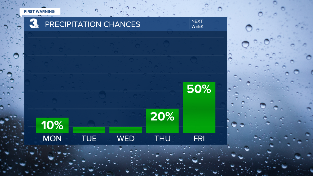
After a frigid start, temperatures will rebound to the upper 40s. It will still be a little on the breezy side. Skies will be partly cloudy.

More sunshine will break out for President's Day. Temperatures will warm to the upper 40s near 50.
Expect very similar conditions on Tuesday with highs in the upper 40s to near 50.
We'll warm to the low and mid 50s by Wednesday. Rain chances will remain low.
Temperatures will soar to the low 60s on Thursday. Most of the day will be dry. Showers will move in late.
Scattered showers to end the work week. Highs will warm to the mid and upper 50s.
More sunshine will break out just in time for the weekend. Highs in the low 50s.

Meteorologist April Loveland
For weather updates on Facebook: HERE
Follow me on Twitter: HERE
Follow me on Instagram HERE
Check out the Interactive Radar on WTKR.com: Interactive Radar
