

Meteorologist April Loveland's First Warning Forecast
High pressure will usher in a gorgeous weekend for us.
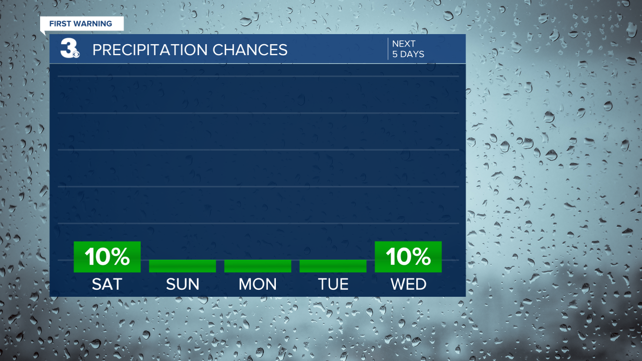
Expect plenty of sunshine today with highs in the mid 60s to low 70s. A stray shower is possible across the Outer Banks. Other than that, it will be dry.
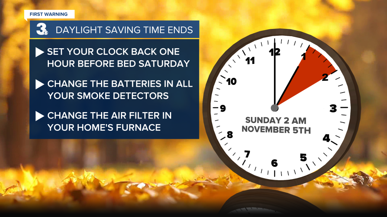
Don't forget! Daylight Saving Time ends at 2 AM Sunday. Before you head to bed tonight, turn your clocks back one hour. It's also a good reminder to change the batteries in your smoke detector and change your furnace filters.
A few degrees milder overnight. Expect a few more clouds with lows in the mid 40s.
Another mild day on tap Sunday. The sun will be rising an hour earlier. Sunrise will be at 6:32 AM. We'll see a few more clouds, but it will be dry with highs in the mid and upper 60s.

More sunshine will break out to kick off the work week. Highs will warm to the upper 60s.
A big warm up on Tuesday. Temperatures will soar to the mid 70s. It will be breezy with winds out of the southwest at 10-15 mph, with higher gusts.
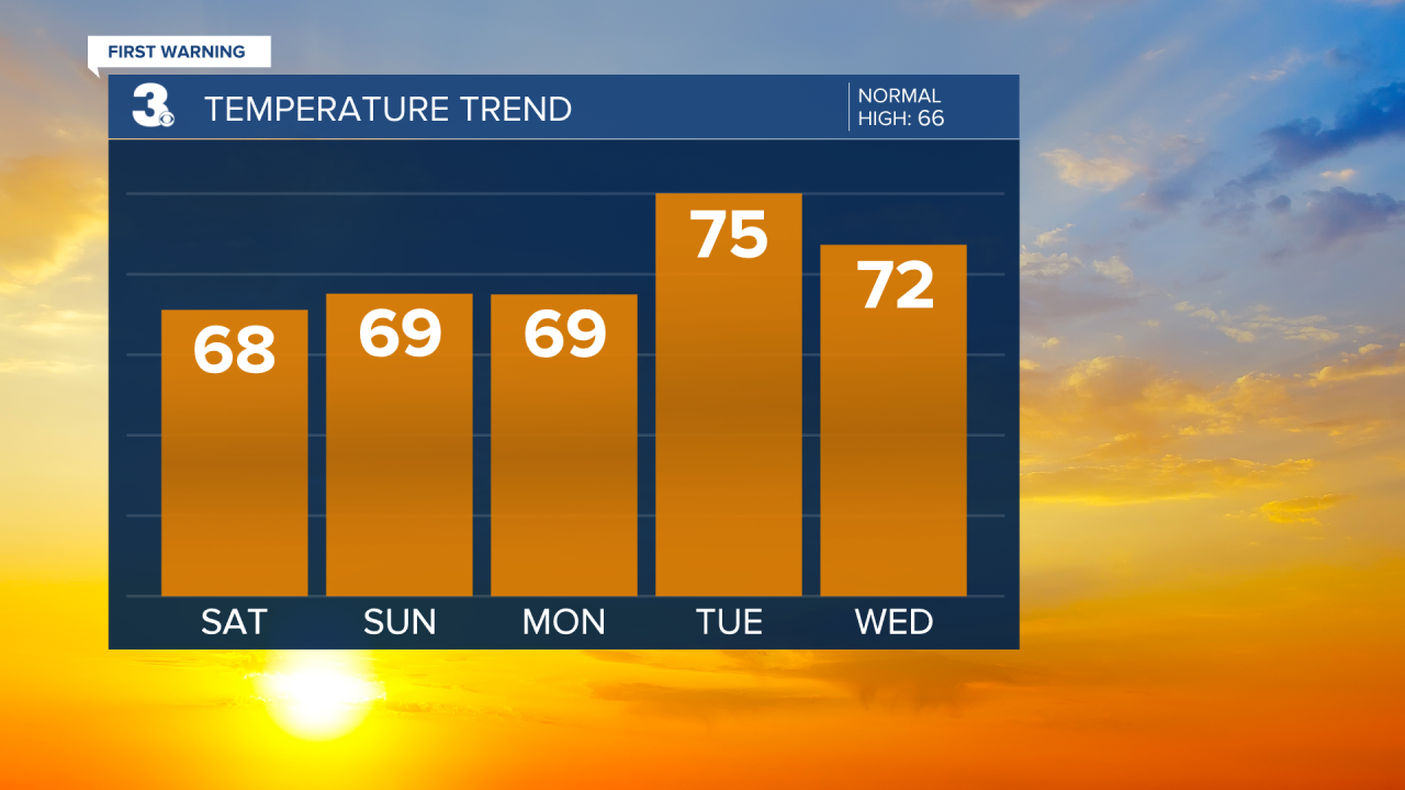
The stretch of 70s will continue into Wednesday with highs in the low 70s under mostly sunny skies.
The warmest day of the week will be on Thursday when temperatures soar to the upper 70s.
A cold front will then move in for the end of the work week. Expect some scattered showers and highs in the mid 60s.
Meteorologist April Loveland
For weather updates on Facebook: HERE
Follow me on Twitter: HERE
Follow me on Instagram HERE
Check out the Interactive Radar on WTKR.com: Interactive Radar
