

Meteorologist April Loveland's First Warning Forecast
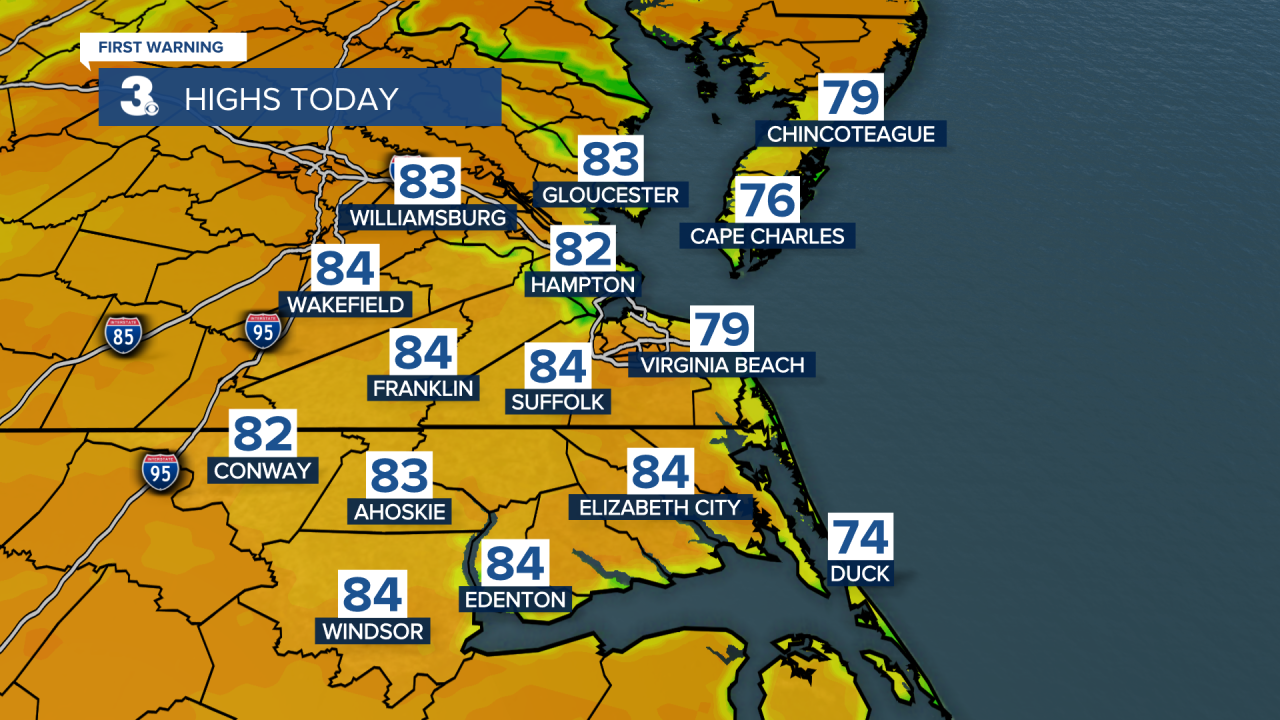
An absolutely gorgeous weekend on tap! Highs in the 80s today, with wall-to-wall sunshine.

Skies will be mostly clear tonight, which means great viewing for the Full Hunter's Moon! Temperatures will fall into the upper 50s to low 60s.

The warm temperatures will continue on Sunday, with highs in the low 80s once again.
Temperatures will continue to trend above normal on Monday. It will be our last warm day with highs in the low 80s.

After that, a cold front will move in. Temperatures will drop into the upper 40s and low 50s Monday night. A few spotty showers will be possible.

Showers will be possible for Halloween. It will also be much cooler with highs in the mid 50s.

A few showers will linger into Wednesday morning. After that, expect skies to clear. It will be windy and cool with highs in the low 50s and winds out of the north at 15-20 mph, with higher gusts.
Dry weather will prevail on Thursday and Friday. Expect highs on Thursday in the mid 50s and warming to the low 60 on Friday.
Meteorologist April Loveland
For weather updates on Facebook: HERE
Follow me on Twitter: HERE
Follow me on Instagram HERE
Check out the Interactive Radar on WTKR.com: Interactive Radar
