

Meteorologist April Loveland's First Warning Forecast
Milder today, but that will come with wind and rain. An area of low pressure will impact the area. Expect highs in the upper 50s to near 60 with rain at times during the day. Drier air will move in this evening, so if you have dinner plans, it shouldn't be too bad.
We'll start off with clouds on Sunday. Skies will clear as the day progresses. It will be a bit cooler with highs in the low 50s.
Plenty of sunshine to kick off the work week with highs in the upper 40s. It will be the coolest day of the week. Clouds will build in ahead of the next big weather maker.

A big warm up and more wet weather on Tuesday. Expect highs in the low 60s. A strong area of low pressure will move in and bring us some soaking rainfall. It will be windy as well with wind gusts 40-50 mph possible. Plan now for it to be a messy day.
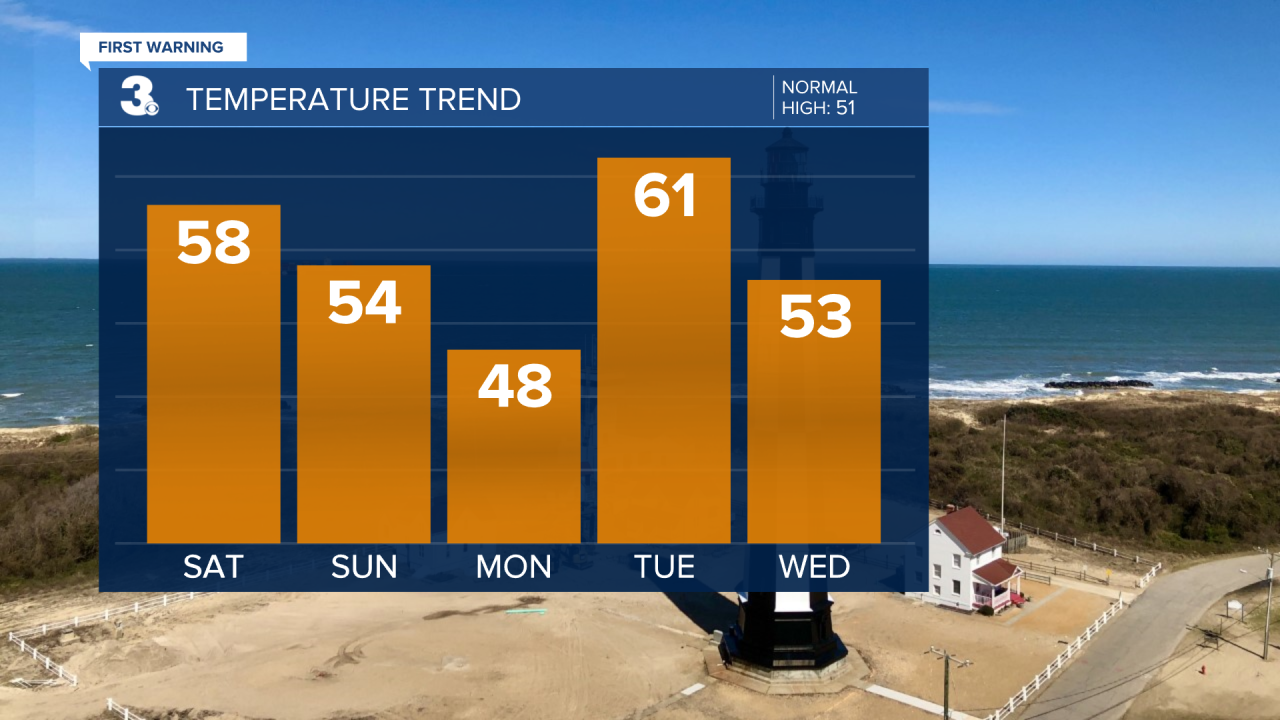
A few lingering showers will be possible on Wednesday. Highs will be in the low 50s.
Plenty of sunshine on Thursday with highs in the low 50s.
A few showers will be possible by the afternoon on Friday. Temperatures will warm to the upper 50s.

Meteorologist April Loveland
For weather updates on Facebook: HERE
Follow me on Twitter: HERE
Follow me on Instagram HERE
Check out the Interactive Radar on WTKR.com: Interactive Radar
