Meteorologist April Loveland's First Warning Forecast
A pleasant day on tap. Expect passing clouds and highs in the mid 70s.

More clouds will build in on Sunday ahead of our next cold front. There isn't a ton of moisture associated with it, but keeping a chance for a shower or storm late. The best chance will be after 9 PM on the peninsulas and Eastern Shore. There is a chance for these storms to become severe. A portion of the area is under a level 1 for isolated severe storms. The biggest threat will be damaging wind gusts. It will be warmer with highs in the mid 80s.

High pressure will build in on Monday along with drier air. Expect sunshine to break out making for a nice and comfortable day. Temperatures will warm to the low 80s. It will be a little breezy with winds around 10-15 mph.
Dry weather will prevail through Wednesday with highs in the upper 70s on Tuesday and low 70s on Wednesday.

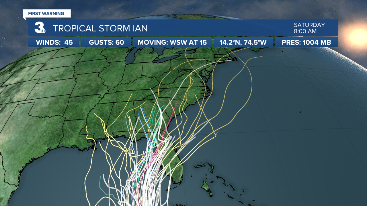
Our eyes then turn to Tropical Storm Ian, currently located over the central Caribbean. There is a potential that we could see some rain and wind by the end of the week and into the weekend. It is still too far out to tell exactly, but something to keep in mind. Right now, we could see potential impacts from late Thursday into Saturday. Stay Tuned!
Tropical Update:

Ian is moving toward the west near 15 mph, and this general motion is expected to continue through tonight. A turn toward the northwest is forecast on Sunday, followed by a north-northwestward turn on Monday and a northward motion on Tuesday. On the forecast track, the center of Ian is forecast to move across the central Caribbean Sea today, pass southwest of Jamaica on Sunday, and pass near or over the Cayman Islands Sunday night and early Monday. Ian will then approach western Cuba late Monday and emerge over the southeastern Gulf of Mexico on Tuesday.
Maximum sustained winds remain near 45 mph with higher gusts. Significant strengthening is forecast during the next few days. Ian is expected to become a hurricane late Sunday or Sunday night and could be at or near major hurricane strength late Monday when it approaches western Cuba.
Tropical-storm-force winds extend outward up to 60 miles from the center.


Meteorologist April Loveland
For weather updates on Facebook: HERE
Follow me on Twitter: HERE
Follow me on Instagram HERE
Check out the Interactive Radar on WTKR.com: Interactive Radar


