

Meteorologist April Loveland's First Warning Forecast
A disturbance will move across the area on Tuesday. This will spark a few isolated showers and storms during the afternoon hours. A few storms could be strong with gusty winds and small hail. Otherwise, expect partly cloudy skies with highs in the upper 70s.

Wednesday will be very comfortable with low humidity and highs in the low 80s. Skies will be partly sunny.
Temperatures and humidity will start to climb on Thursday. It's looking dry with highs in the mid and upper 80s. Expect plenty of sunshine throughout the day.
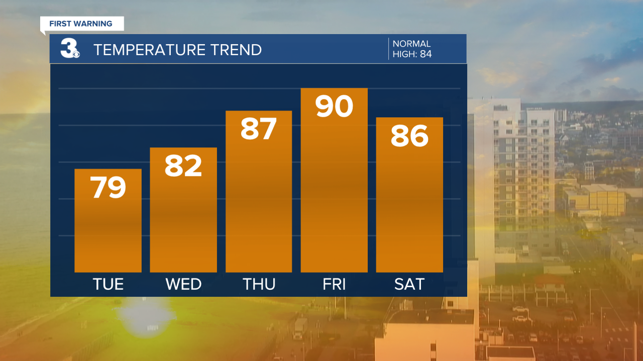
Friday will be the hottest day with highs soaring to 90 degrees! Once we factor in the humidity, it will feel closer to the upper 90s.

Father's Day weekend is looking pretty good!
We'll see highs in the mid 80s on Saturday under mostly sunny skies. Father's Day is looking dry with highs in the low 80s. Skies will be partly cloudy.

Meteorologist April Loveland
For weather updates on Facebook: HERE
Follow me on Twitter: HERE
Follow me on Instagram HERE
Check out the Interactive Radar on WTKR.com: Interactive Radar
