

Meteorologist April Loveland's First Warning Forecast
Minor tidal flooding will be possible Wednesday 12 AM and again at 12 PM.

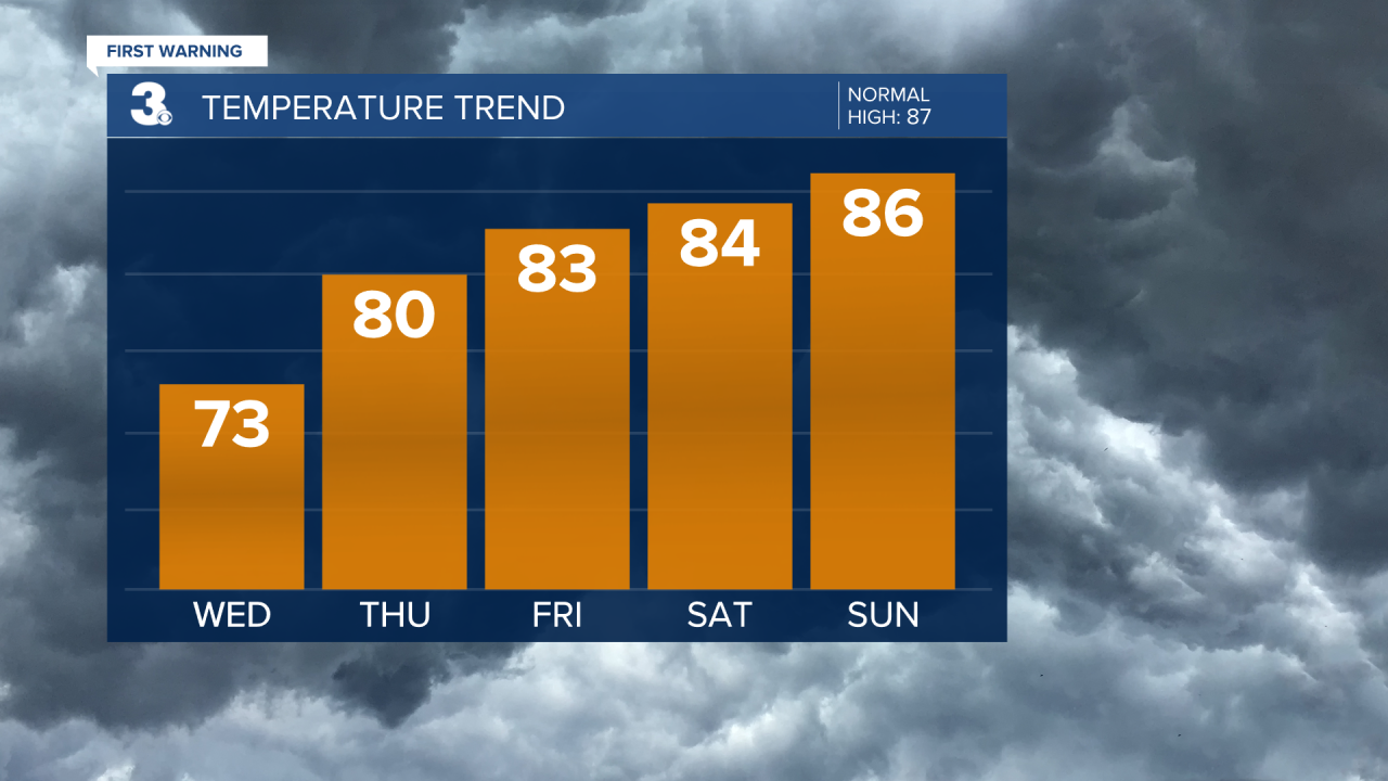
The First Day of Summer is on Wednesday, and it's looking to be humid, windy and stormy. Expect highs in the low and mid 70s with showers and storms. Winds will be out of the east at 15-20 mph, with higher gusts.
The rest of the week and into the weekend will be very unpleasant due to the humidity. Dewpoints will climb into the low 70s. We haven't really had to deal with that much humidity this season, so it will be a bit of a rude awakening.

Temperatures will trend in the low and mid 80s for the rest of the week and into the weekend.

Scattered showers and storms will be possible through the weekend and even into the start of the work week. We will see quite a bit of rain during this time which could lead to some flooding. We will also have to deal with a bit of tidal flooding as well.
Tropical Update:

Meteorologist April Loveland
For weather updates on Facebook: HERE
Follow me on Twitter: HERE
Follow me on Instagram HERE
Check out the Interactive Radar on WTKR.com: Interactive Radar
