


Meteorologist Kristy Steward's First Warning Forecast
Happy Saturday evening! Tomorrow is the day many of us have been waiting for.. The day our gloomy pattern finally ends and sunshine returns! Temperatures will stay on a warming trend with more sunshine around.
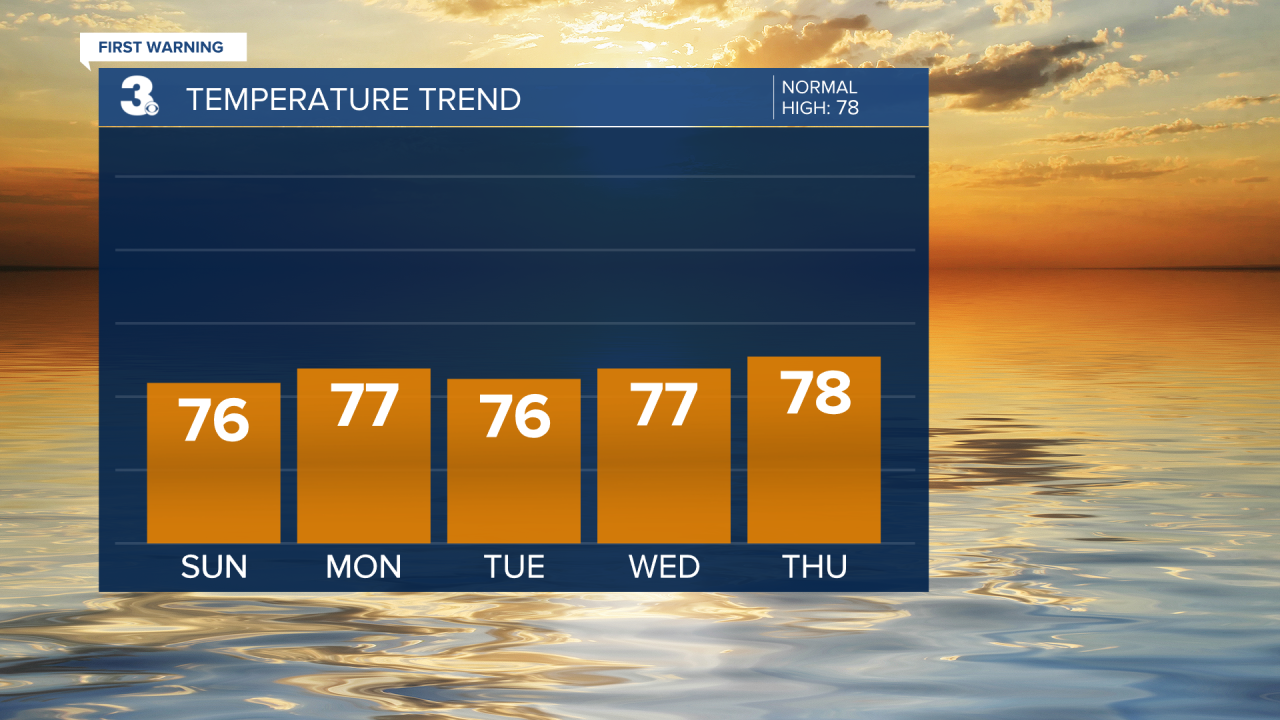
High pressure starts to settle in tonight and sticks around influencing our weather through Thursday. This means Sunday through Thursday will be dry with lots of sunshine each day. High temperatures will rise into the upper 70s by the end of the workweek.
The one thing that doesn’t change in this pattern flip is the breezy northerly wind. That will keep tidal flooding around each high tide cycle for the near future. Around 1 foot of inundation is expected, so mainly impacting our flood-prone areas.

Friday evening, a cold front passes through. That front will likely bring us increasing cloud cover Friday into Saturday along with some scattered rain Friday night throughout Saturday morning. Of course, the timing of that rain could change since this event is so far out. The cold front looks to drop our temperatures just a few degrees back down to the mid 70s Saturday.
Connect with Meteorologist Kristy Steward:
FACEBOOK
TWITTER
INSTAGRAM
