

Meteorologist April Loveland's First Warning Forecast
A quiet last weekend of 2023.

New Year's Eve will be sunny and dry. Highs will top out in the low 50s. It will actually be one of the cooler New Years we've had in a few years.


Increasing clouds for New Year's Day with highs in the low 50s. Not a bad way to kick off the first day of 2024. A cold front will move through bringing a chance for a few spotty showers late Monday night into Tuesday morning.
Tuesday will be much cooler with highs in the mid 40s. It will be a bit on the breezy side.
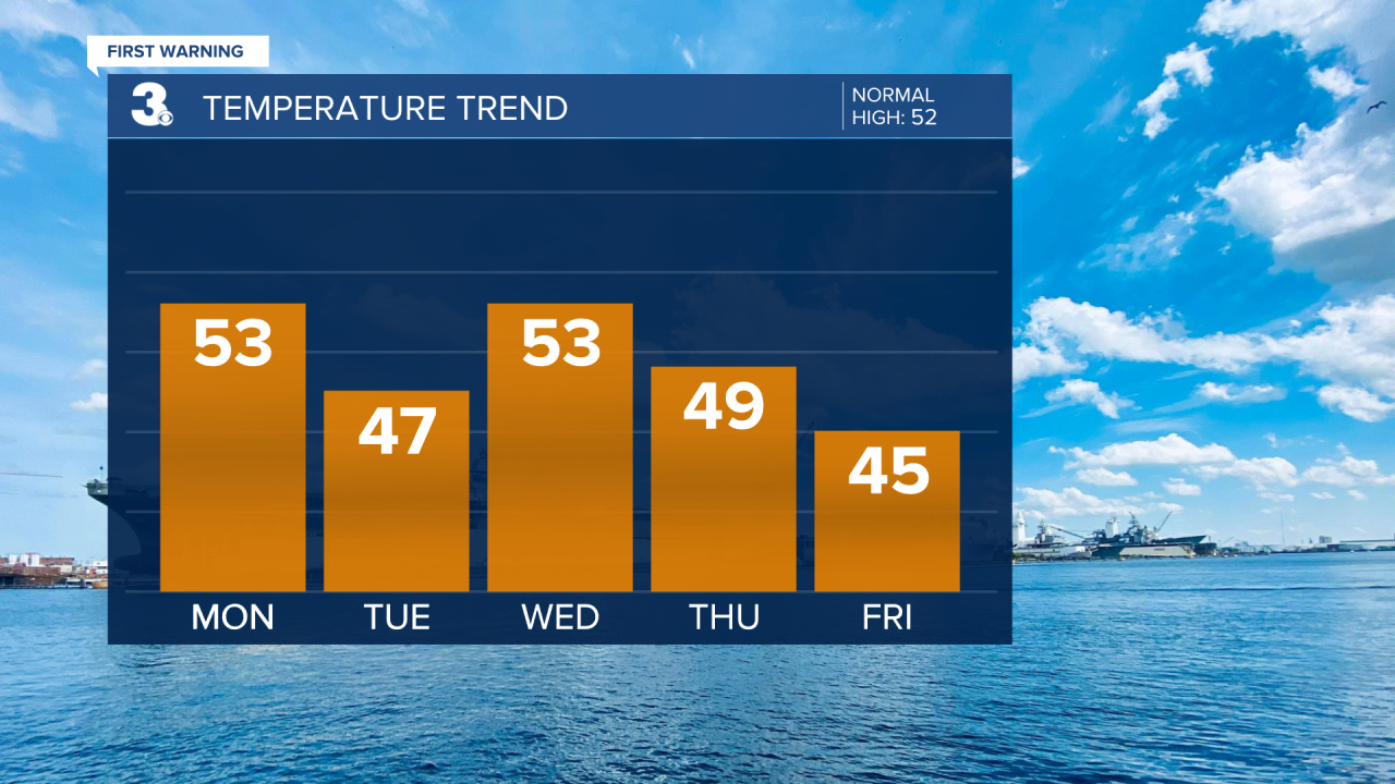
Clouds will build in on Wednesday with highs back into the low 50s.
Grab the umbrellas on Thursday! Scattered showers will be possible. Temperatures will top out in the upper 40s to near 50.

A big cool down just in time to end the work week. Expect highs to only warm to the low 40s. Back to normal temperatures on Saturday. Expect highs in the low 50s with scattered showers possible.

Meteorologist April Loveland
For weather updates on Facebook: HERE
Follow me on Twitter: HERE
Follow me on Instagram HERE
Check out the Interactive Radar on WTKR.com: Interactive Radar
