


Chief Meteorologist Patrick Rockey's First Warning Forecast
Talk about your 50/50 weekend! Saturday is going to be pretty spectacular. Sunday is going to be pretty ugly.
We have a powerful cold front moving in our direction. Ahead of that front, a southerly wind will send temperatures climbing into the upper 60s and lower 70s on Saturday. Get out and enjoy it, because Sunday will by wet and stormy as that cold front crosses the region.

Our entire region is under a Level 1 storm threat from the Storm Prediction Center. And we could even be upgraded to a Level 2.

What does that mean? Damaging winds are the top concern. We could see some 60 mph+ wind gusts, along with heavy downpours that could cause some localized flooding. Some large hail and isolated tornadoes are also concerns for us as the storms move through.
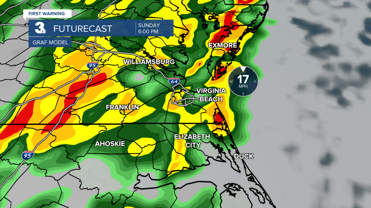
It looks like the heaviest downpours and the biggest threat for severe weather will come in the late afternoon and evening on Sunday. But a few showers are even possible during the first half of the day.
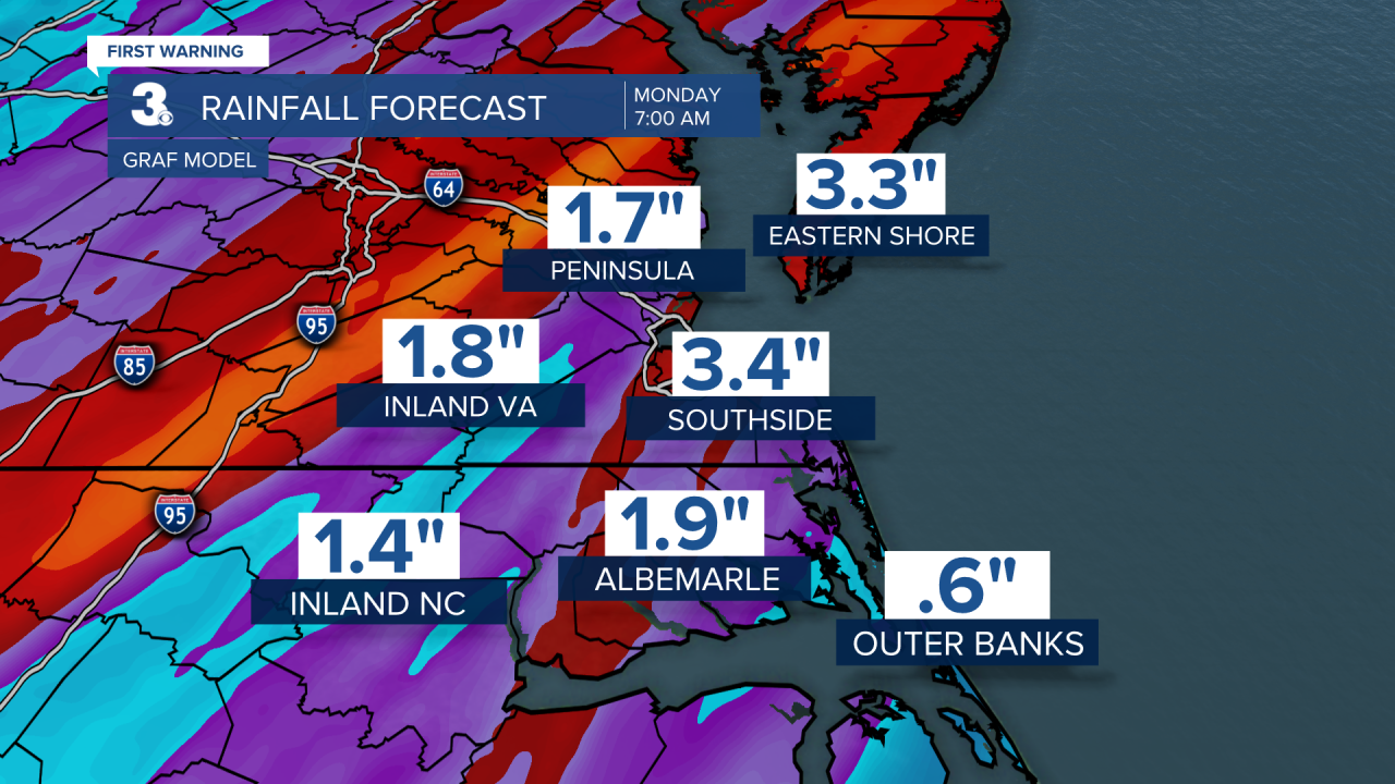
Showers and storms will likely linger after midnight. But the stormy weather will likely be gone by the time you step out the door on Monday morning.
The mild weather will also be gone. In fact, we're expecting below-normal temperatures all through the work week. Stay tuned.
