


Meteorologist Kristy Steward's First Warning Forecast
Happy Sunday evening! We had a pretty nice day with warmer temperatures and some sunshine. It was still on the cool side though. The 80s make a return this week.
Tonight, temperatures drop into the mid to upper 50s. Under a partly cloudy sky Monday, temperatures will return to the upper 60s along the coast and lower 70s inland. The first half of the week stays dry.
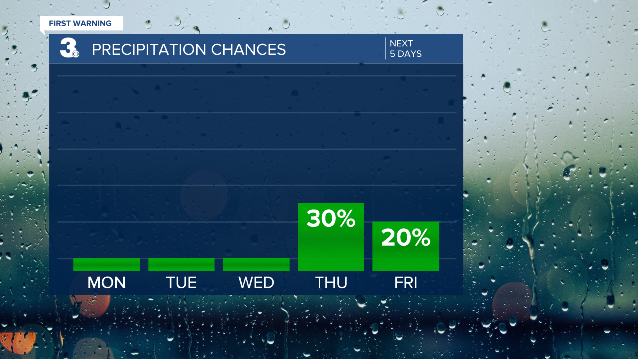
Under the influence of high pressure, there will be lots of sunshine Tuesday and Wednesday. High temperatures will make some big jumps into the mid 70s Tuesday and mid 80s Wednesday.
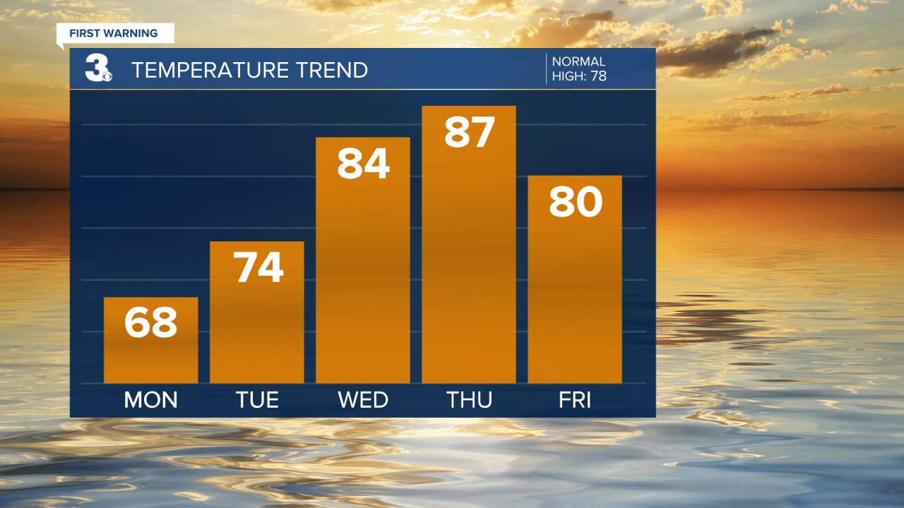
We top out in the upper 80s Thursday before a cold front cools us down to the low 80s Friday and upper 70s for the weekend. That cold front will likely bring a round of scattered rain showers with it Thursday evening through the night. Then, an unsettled pattern could bring scattered storms throughout the day Saturday. Sunday looks decently dry right now, but that could change.
Connect with Meteorologist Kristy Steward:
FACEBOOK
X
INSTAGRAM
