


Meteorologist Kristy Steward's First Warning Forecast
Happy Saturday evening! Scattered rain showers and thunderstorms move through tonight into Sunday, then we dry out and cool down.
Scattered storms with some heavier downpours throughout the night tonight and Sunday morning could create localized flooding, especially across the peninsulas where the most rain is expected to fall. In any dry breaks, patchy fog could form.
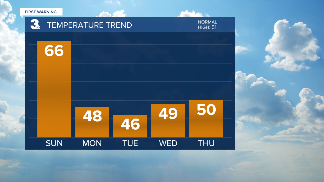
Overnight lows will be reached just after Midnight in the upper 40s. Then, we’ll gradually warm up. So, by the time most wake up, temperatures will be in the mid 50s. We warm to the mid 60s in the afternoon.
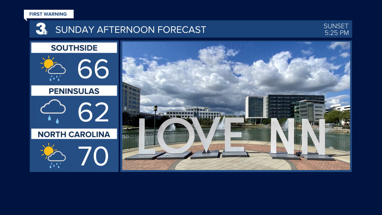
There will be a period of sunshine primarily across southside and northeastern NC Sunday afternoon. Isolated rain showers on the backside of this system could fall the second half of Sunday.
Monday will be mostly dry, but hold onto a lot of cloud cover. It will be a breezy and cool day. High temperatures in the upper 40s. Northwesterly winds gusting to 30 MPH.
Tuesday will be a bit cooler yet in the mid 40s. We stay dry and see a little more sunshine.
A weakening low pressure system passes through Wednesday. That will bring us more cloud cover and isolated to scattered rain showers throughout the day. Winds will also pick up a bit. Temperatures will warm a few degrees in the upper 40s.

We reach the low 50s Thursday and now are trending mostly dry with more sunshine.
Mostly sunny to partly cloudy and breezy Friday and Saturday. Temperatures warm into the mid 50s Friday, then cool back down to the upper 40s Saturday behind a cold front.
Connect with Meteorologist Kristy Steward:
FACEBOOK
TWITTER
INSTAGRAM
