


Meteorologist Myles Henderson’s First Warning Forecast
Scattered showers and storms today. More heat and humidity this weekend. Another round of showers and storms to end the weekend.
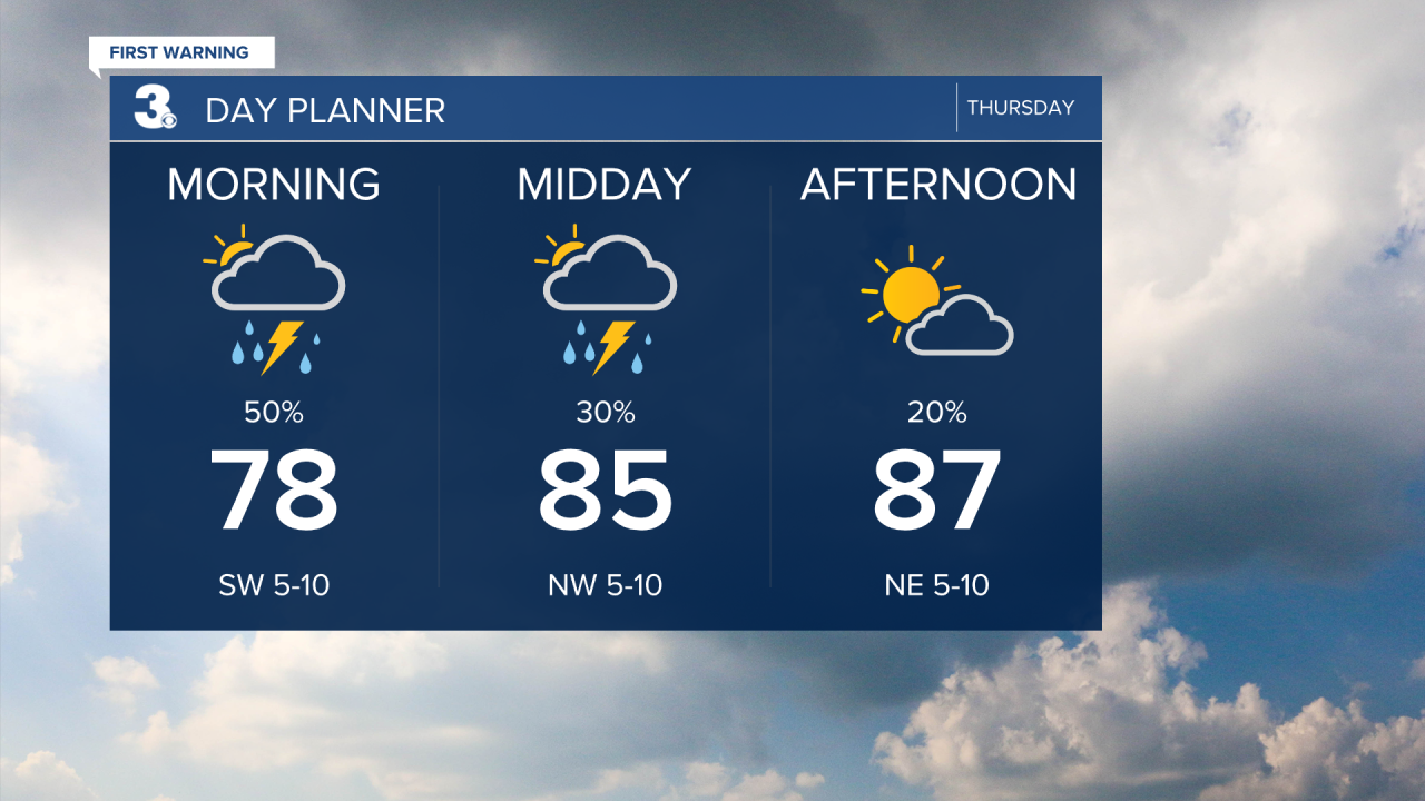
Showers and storms will move through this morning as a cold front pushes through the region. Expect partly to mostly cloudy skies with rain chances dropping through the day. Highs will dip to the upper 80s but it will still be humid.
A nice day on Friday with a mix of sun and clouds. Highs will drop to the mid-80s.
Cranking up the heat and humidity again this weekend. Highs will reach the low 90s on Saturday and the mid 90s on Sunday. Afternoon heat index values will be pushed to the triple digits both days. Expect partly cloudy skies on Saturday and another round of showers and storms on Sunday.
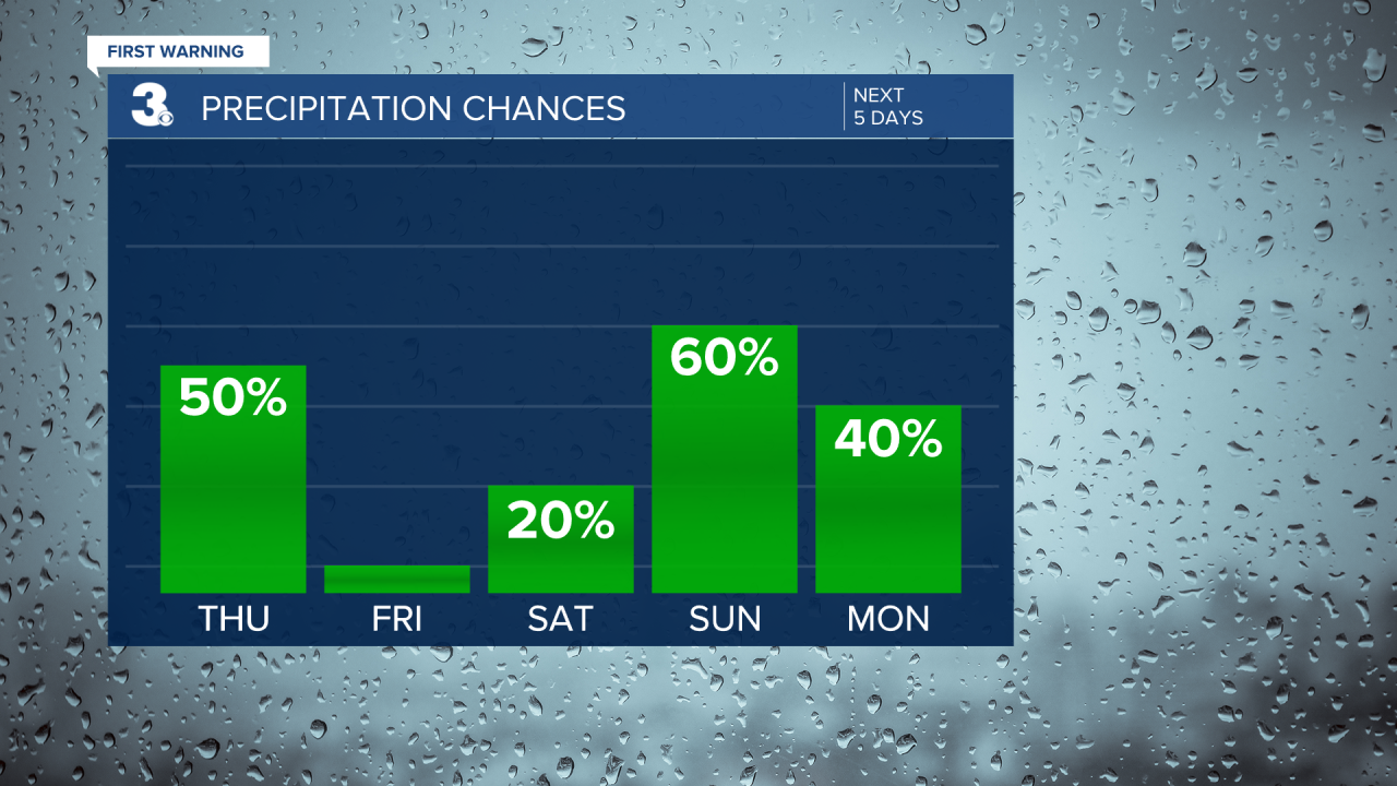
Showers and storms may linger for Monday morning, but we will see clearing skies through the day. Highs will drop to the low 80s with lower humidity to start the work week.
Today: Mostly Cloudy, AM Storm. Highs in the upper 80s. Winds: SW/NE 5-10
Tonight: Partly Cloudy. Lows in the low 70s. Winds: E 5-10
Tomorrow: A Few Clouds. Highs in the mid 80s. Winds: E 5-15
Tropical Update
Tracking a tropical wave located several hundred miles southwest of the Cabo Verde Islands. Environmental conditions are forecast to be unusually conducive for late June across the central and western tropical Atlantic, and further development of this system is anticipated. A tropical depression or tropical storm is likely to form this weekend several hundred miles east of the Windward Islands while the system moves west.
* Formation chance through 48 hours: Medium (40%)
* Formation chance through 7 days: High (70%)

Tracking a tropical wave over the west-central Caribbean Sea. Environmental conditions could become more conducive for some gradual development later this week over the western Caribbean Sea or over the southwestern Gulf of Mexico during the weekend.
* Formation chance through 48 hours: Low (10%)
* Formation chance through 7 days: Low (20%)
Weather & Health
Pollen: Low-Mod (Grasses)
UV Index: 6 (Moderate)
Air Quality: Moderate (Code Yellow)
Mosquitoes: Extreme
Weather updates on social media:
Facebook: MylesHendersonWTKR
Instagram: @MylesHendersonWTKR
X (Twitter): @MHendersonWTKR
