

Meteorologist Kristy Steward's First Warning Forecast
Happy Friday evening! Scattered showers and storms continue to move through tonight, then a windy weekend is in store.
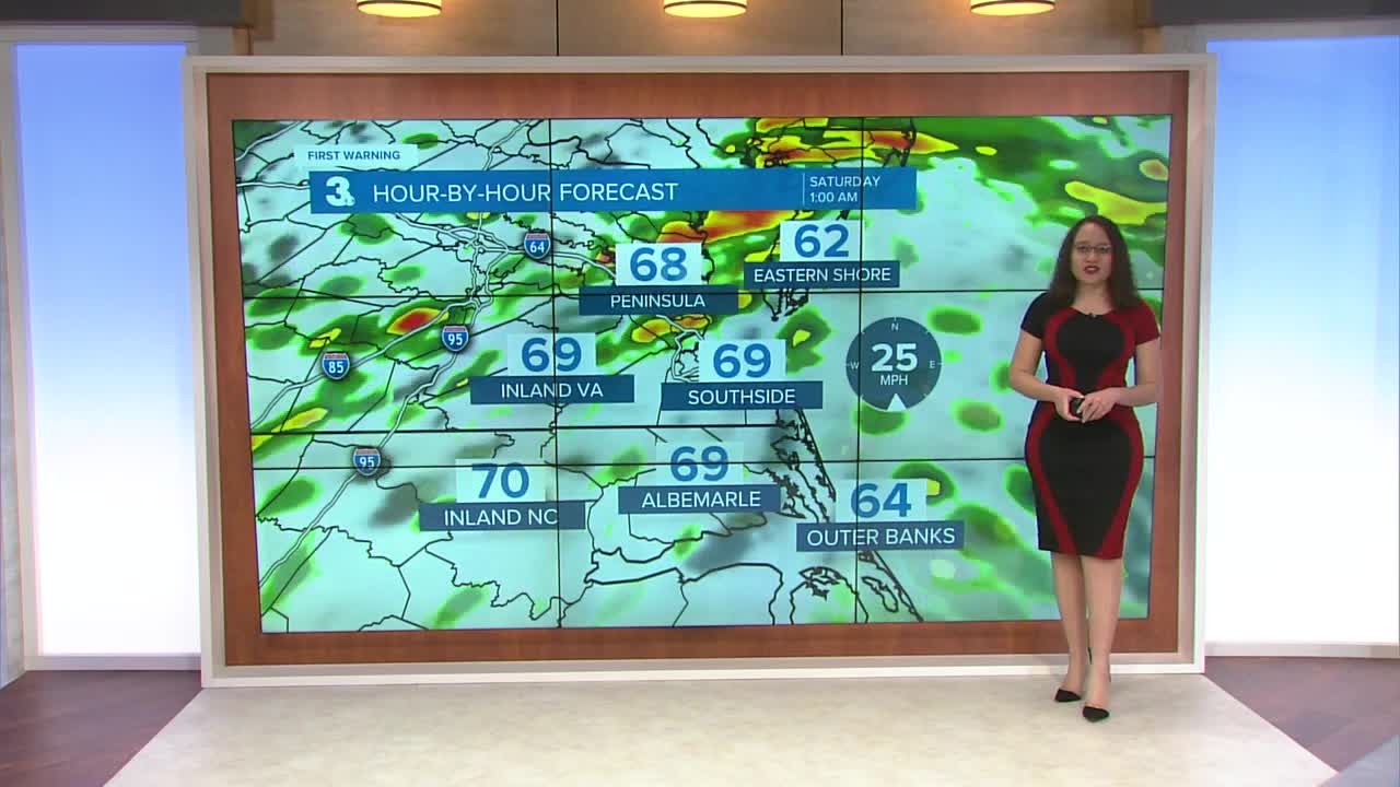
A system passing through now is bringing us scattered rain showers and some thunderstorms. We are under a level 1 of 5 risk for severe storms. Damaging wind gusts are the primary threat. Localized flooding is also possible. While showers continue throughout the night, our severe threat should end around Midnight. The good news is, so far, this system hasn’t produced many warnings, so we have a decent chance at dodging severe storms. Either way, it will still be wet and windy.

Wind Advisory along the coast until 4 AM Saturday. 25-30 MPH southerly winds with 50 MPH gusts.

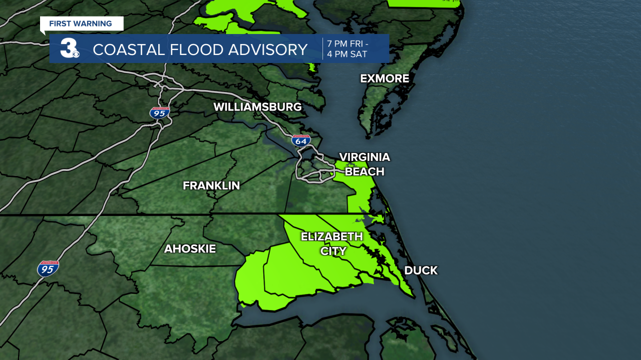
Coastal Flood Advisory for the Albemarle Sound and Virginia Beach until 4 PM Saturday. Expect around 1 foot of inundation.
High Surf Advisory for the Eastern Shore 10 PM Friday - 10 AM Saturday. Expect 8-10 feet breaking waves.
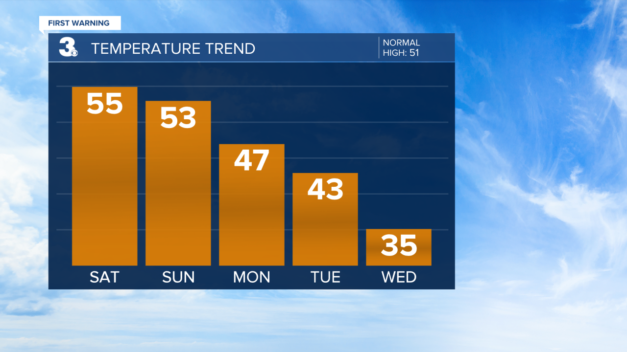
By sunrise Saturday, we’ll be dry with clearing clouds. Winds stay strong throughout Saturday. Sustained winds up to 30 MPH with stronger gusts. Temperatures gradually drop as the day goes on, so our highs will be reached early in the morning. Lower 50s to upper 40s in the afternoon.
Sunday stays dry. High temperatures in the lower 50s. Clouds build ahead of our next system Monday and temperatures continue on a gradual cooling trend. Highs Monday in the mid to upper 40s.
We fall to high temperatures in the low 40s Tuesday and reach our coolest day on Wednesday with highs in the mid 30s. Then, the second half of the workweek, temperatures rebound to the mid 40s.
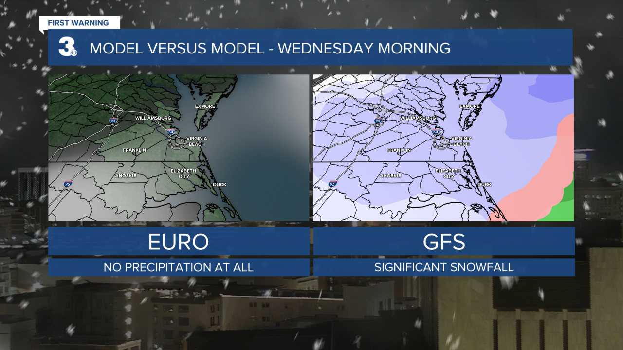
As for precipitation with this mid-week system, scattered rain showers Tuesday could turn to snow showers Tuesday night into Wednesday morning as temperatures fall from the 40s to 20s. Overnight lows in the mid 20s will feel like the teens with gusty winds.
Our snow potential is very up in the air. It really depends how much moisture is left in this system when the temperatures drop below freezing. One model has us getting no snow while the other shows us getting some snowfall. We’ll keep monitoring and keep you updated.
Connect with Meteorologist Kristy Steward:
FACEBOOK
TWITTER
INSTAGRAM
