


Meteorologist Kristy Steward's First Warning Forecast
Happy Friday night! Scattered storms ended our dry streak today. More scattered storms are on the way for the rest of the weekend, but it won’t be a washout.
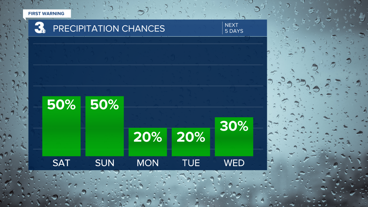
Most of the storms and rain have now cleared out. Some showers overnight are possible, but the next best chance for scattered showers and storms is Saturday afternoon and evening. Then again Sunday afternoon and evening. In any of these storms, heavy downpours could create localized flash flooding. Expect another 1-2” of rainfall this weekend.

Both days this weekend will have highs in the low 90s, feeling like 100-110°. Sunday will likely feel a touch hotter than Saturday.

We catch a dry break Monday and Tuesday, but the high heat and humidity stick around. Highs in the low 90s all next week with feels-like temperatures 100-105°. Daily isolated to widely scattered storm chances return Wednesday and last throughout the rest of the workweek.
Connect with Meteorologist Kristy Steward:
FACEBOOK
TWITTER
INSTAGRAM
