

Meteorologist April Loveland's First Warning Forecast
Tuesday brings a bit more activity with scattered storms in the forecast and highs in the mid 80s. There’s a chance you might see some rain, so keep an umbrella handy.
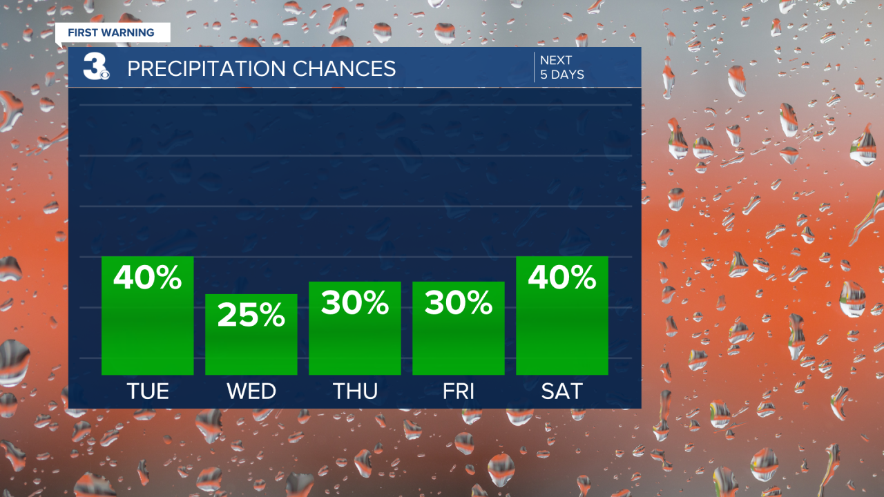
Wednesday will be quite warm with temperatures warming to the low 90s. The heat index will make it feel close to 1020°F, and we're keeping slight chance for isolated storms.
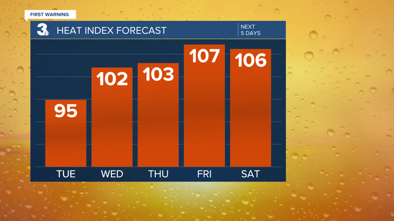
Thursday continues the trend of hot and humid weather with a highs in the low 90s. The heat index will range from 105-110, and again, we've got a chance of thunderstorms.
Friday turns up the heat even more highs soaring to 94 degrees and a heat index that could soar past 105 degrees. Keeping a chance for scattered afternoon or evening thunderstorms.
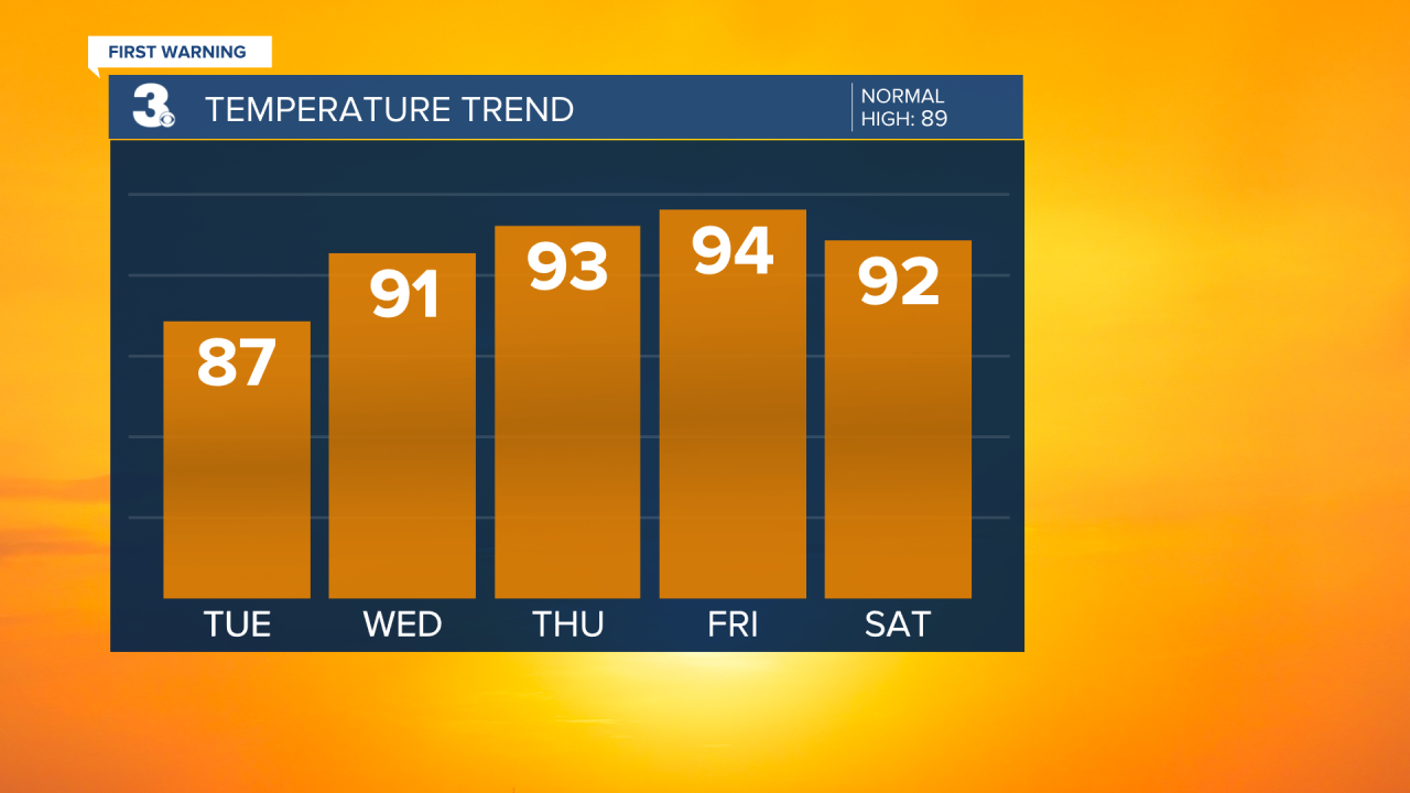
The weekend stays steamy with Saturday hitting the low 90s. It’ll be hot and humid with a chance of storms, so outdoor plans might be a bit tricky.
Sunday wraps up the week with highs in the low 90s once again. The weather remains hot and humid, and there’s a chance for showers and storms once again.
Stay cool and hydrated this week, and keep an eye out for those scattered storms!
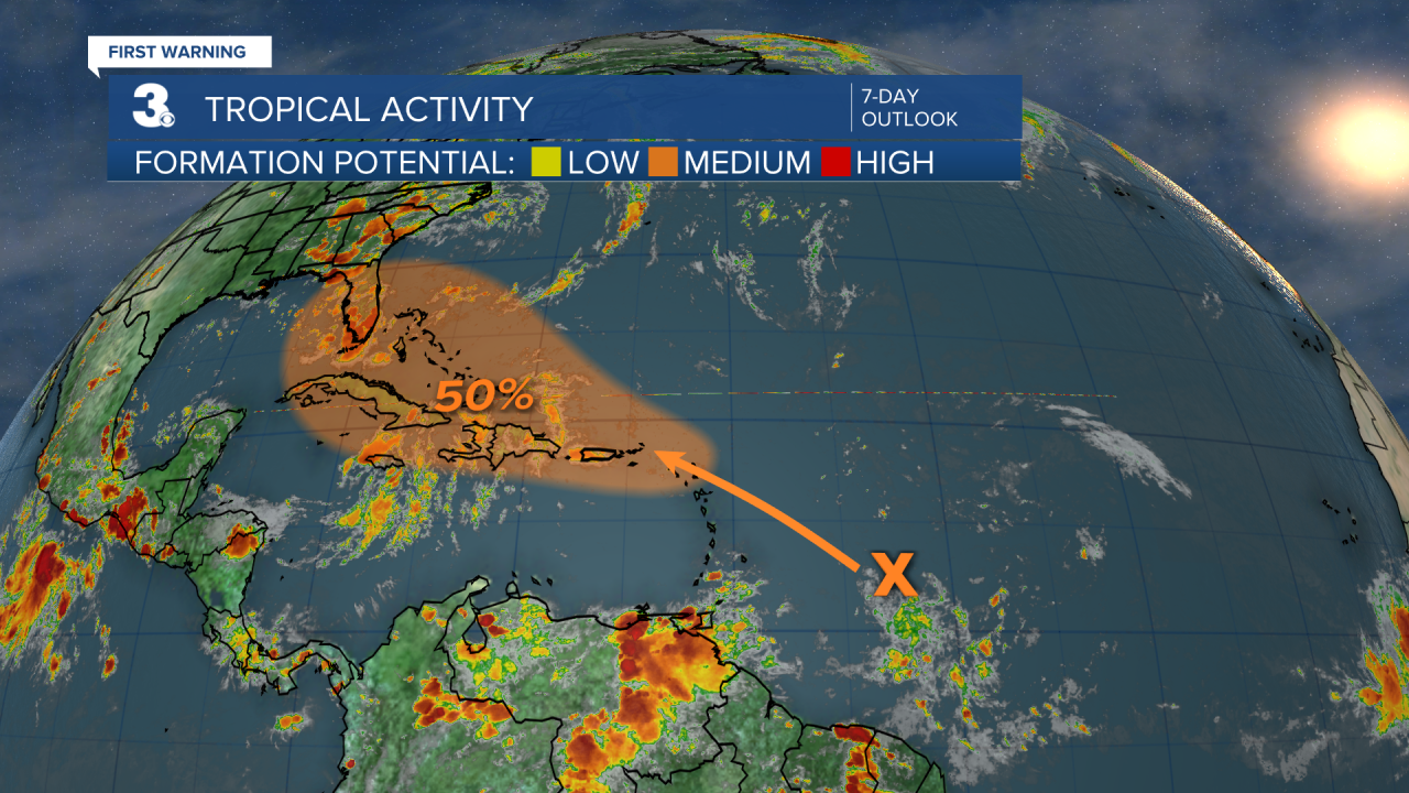
Tropical Update:

Meteorologist April Loveland
For weather updates on Facebook: HERE
Follow me on Twitter: HERE
Follow me on Instagram HERE
Check out the Interactive Radar on WTKR.com: Interactive Radar
