


Derrah Getter's First Warning Forecast
The daytime heating will fuel the potential for some strong storms this evening and overnight. The Storm Prediction Center has issued a level 1 threat for isolated severe thunderstorms. The primary threat will be damaging winds but large hail is also a possibility.

Due to a series of back to back cold fronts, our rain chances stay elevated through next week. Friday will feature storm chances in the morning and in the evening. The high temperatures won't be as hot but the humidity won't be going anywhere until both cold fronts pass through. Once that happens, highs will fall back to the upper 70s by the middle of next week.
If you've got any plans for Labor Day, it's looking good for the most part. You may need to dodge some afternoon showers and storms but humidity will be dropping Monday with temperatures in the low to mid 80s.

Tropical Update
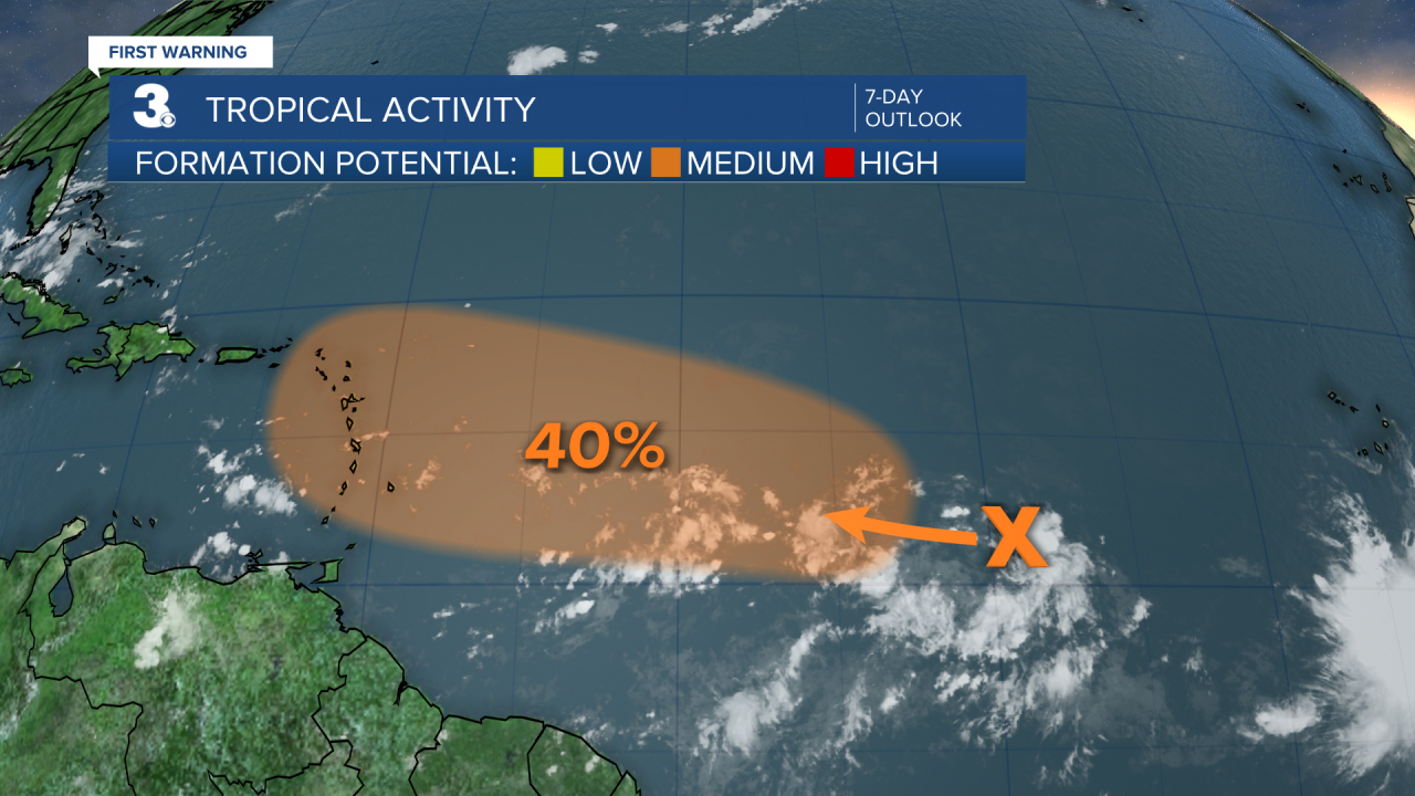
As of 8/29/24 at noon
A tropical wave over the central Atlantic is producing disorganized showers and thunderstorms. Environmental conditions appear favorable for this system to become a tropical depression early next week.
- Formation chance through 48 hours...LOW (near 0%)
- Formation chance through 7 days...MEDIUM (40%)
Let's connect on social media!
Forecaster Derrah Getter:
For weather updates on Facebook: HERE
For weather updates on Twitter: HERE
Follow me on Instagram: HERE
Check out the Interactive Radar on WTKR.com: Interactive Radar
