


Meteorologist Kristy Steward's First Warning Forecast
Happy Thursday evening! Heat, humidity, and daily storm chances remain the story for the next several days.
Spotty storms this evening will come to an end soon after dark. Drier overnight with lows in the low to mid 70s.
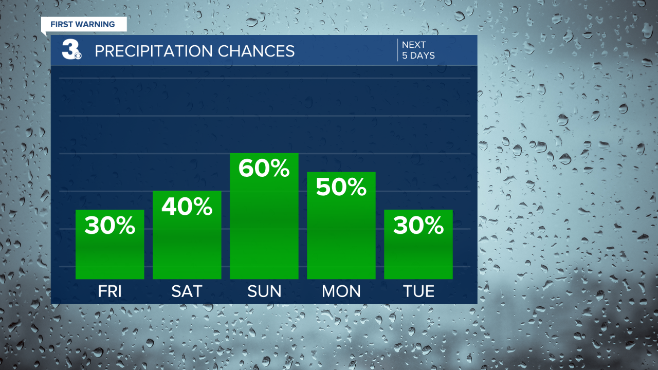
Friday will be in the upper 80s, feeling like the mid 90s. In the afternoon and evening hours, our inland communities will have scattered thunderstorms, but they look to dissipate before reaching the coast.
This weekend won’t be a washout, but scattered showers and thunderstorms will develop each afternoon and evening. If you need to get anything done outdoors, do it in the morning when it’s drier and not as hot. High temperatures will be in the upper 80s, feeling like the upper 90s once you factor in the humidity both days this weekend.

More afternoon and evening scattered storms are in store for the start of the week Monday into Tuesday. Highs on Monday will be slightly cooler in the mid 80s, but still feeling like the mid 90s. We return to the upper 80s Tuesday. However, behind a cool front, dew points will be lower on Tuesday. So, we’ll catch a brief break from the high humidity and feel a little cooler, like the lower 90s. Humidity makes all the difference!
The second half of next week is when we get out of this unsettled pattern and dry out. We stay with a mix of sun and clouds, but get even hotter. Highs in the low 90s each day.
Connect with Meteorologist Kristy Steward:
FACEBOOK
TWITTER
INSTAGRAM
