


Meteorologist Kristy Steward's First Warning Forecast
Happy Thursday evening! Hopefully you enjoyed the beautiful weather today or got some yard work done before the showers started to move in. Our weather pattern is shifting and we have some wet weather in store along with rising temperatures and humidity.
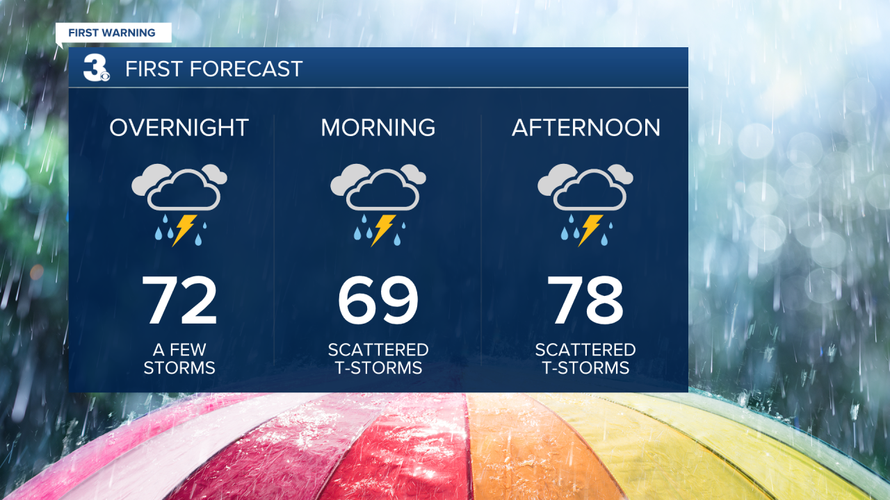
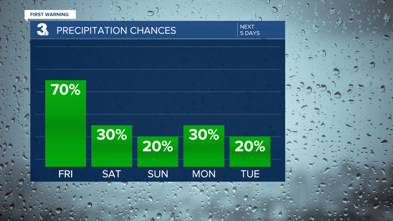
Scattered showers with a few embedded thunderstorms will continue throughout tonight and all day Friday. Not a washout, but off and on rounds of scattered activity. Overnight lows will still drop down to the upper 60s. High temperatures will be cooler Friday in the upper 70s because of the additional cloud cover and rain showers.
A few lingering showers are possible Saturday morning, but most of the weekend looks decently dry. However, temperatures and humidity will be on the rise. Highs in the mid to upper 80s, feeling like the low to mid 90s.
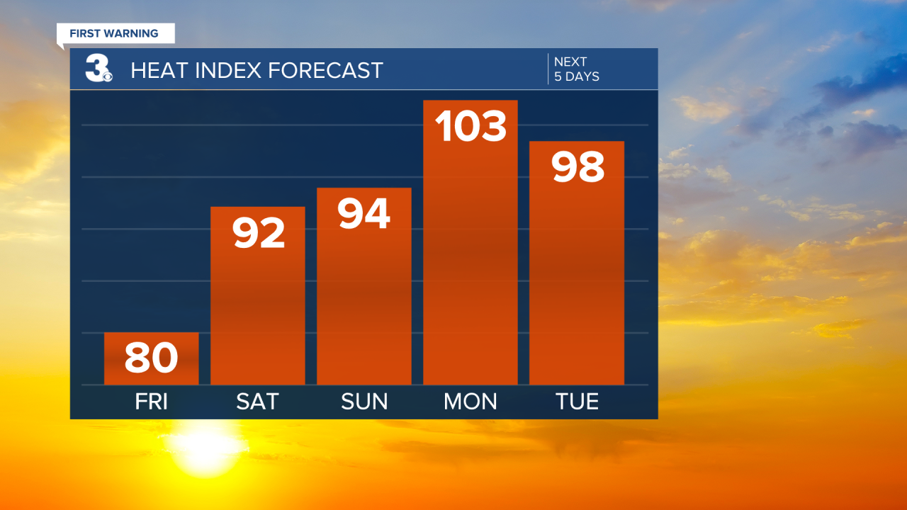
Monday will be the hottest day of the week. Highs in the lower 90s, feeling like 100-105°. A system approaches on Monday, bringing us isolated storms. Temperatures will be in the upper 80s to low 90s the rest of the workweek. Near daily chances for isolated storms, but plenty of dry breaks. Tuesday looks to be the driest and sunniest day.
Connect with Meteorologist Kristy Steward:
FACEBOOK
TWITTER
INSTAGRAM
