Meteorologist Kristy Steward's First Warning Forecast
Happy Saturday evening! I hope you enjoyed today’s sunshine while it was around. Another system brings us clouds, rain, and tidal flooding the next couple days. We stay with below-normal temperatures too until late next week.
Ahead of this next system, clouds will gradually increase tonight. Overnight lows will drop into the mid and upper 30s. Don’t forget, we Spring Forward and lose an hour tonight at 2 AM when Daylight Saving Time begins!

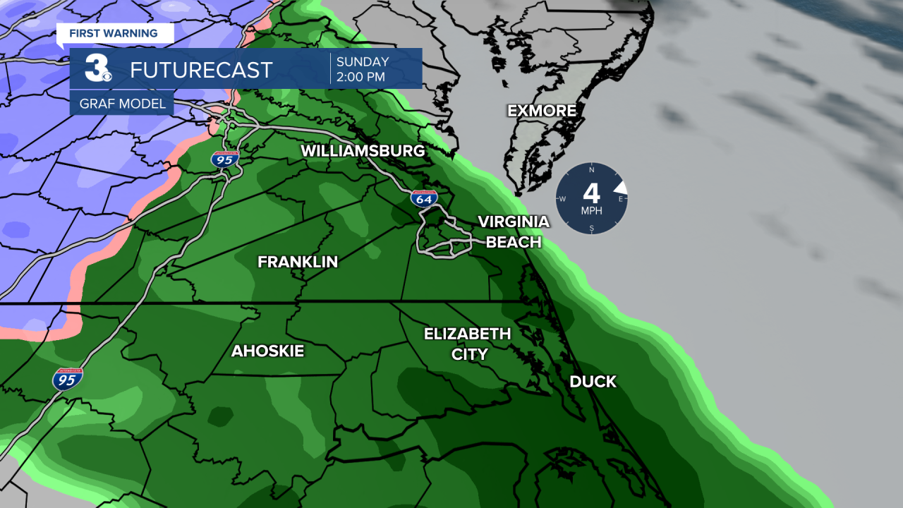
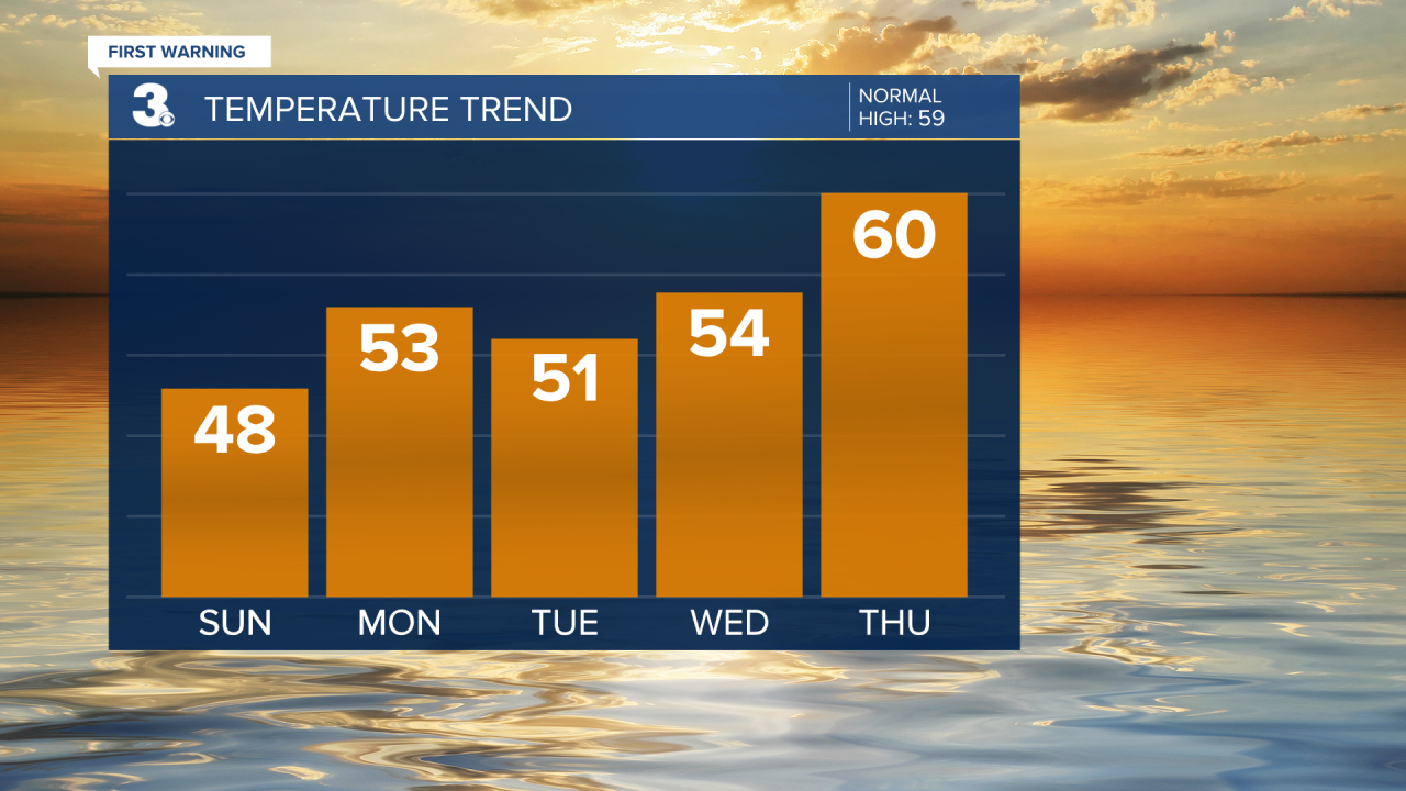
Heading into Sunday, it will be a cloudy day. Scattered rain showers look to begin entering our inland communities around 10 AM and continue throughout the rest of the day, night and Monday morning. We could even see lingering showers across the Peninsulas and Eastern Shore until Monday evening. With this system, temperatures will be cooler Sunday in the upper 40s and slightly warmer in the low to mid 50s on Monday.

As this system clears out, winds will pick up later Monday and throughout Tuesday into Wednesday. These stronger winds will bring us minor tidal flooding with 1-2 feet of inundation during the high tide cycles Sunday and Monday. Areas that typically see tidal flooding will have some roads become impassable at high tide.

Clouds will also clear out behind this system, but there could be some wrap-around clouds on the backside that pass through Tuesday afternoon. Either way, once we dry out Monday, we stay dry until Friday night. Temperatures will also eventually warm up.
Expect high temperatures in the low 50s Tuesday to rise into the mid 50s Wednesday. We finally hit seasonable high temperatures around 60° on Thursday. While our high temperatures will be climbing that entire time, our overnight lows will be quite chilly under mostly clear skies. Lows will be near freezing, especially for our inland communities, Tuesday-Thursday mornings. Eventually lows warm up with that seasonable jump Thursday night. High temperatures even jump to near 70° Friday.

Then, another system passes through. This will bring stronger winds along with scattered rain showers Friday night throughout Saturday. Temperatures Saturday will be a bit cooler in the lower 60s.
Connect with Meteorologist Kristy Steward:
FACEBOOK
TWITTER
INSTAGRAM


