Meteorologist Jim Duncan's First Warning Forecast
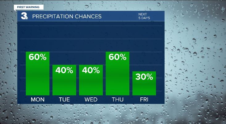
Weather for the upcoming week will be controlled by an active stream of disturbances running from west to east across the South along a stationary boundary hovering close to Virginia and the Carolinas. This makes it a tricky forecast with respect to how much rain we'll see over the area, with the lines drawn between dry air from the north and those impulses of precipitation so nearby. Much colder air will seep southward as the week goes on, so a taste of a little wintry mix can't be ruled out for some areas from midweek through early Friday. There will be chances for precipitation for each of the next 5 days. Given the uncertainty of timing we'll of course continue to monitor the trends and update.

Overnight through Monday: Cloudy with periods of rain into Monday morning. Look for some afternoon sun to return as low pressure moves quickly east of North Carolina. High temperatures in the mid to upper 50s once the clouds break.

Tuesday: Cloudy with some later day rain showers. Could be some light wintry mix towards Wednesday morning. Highs upper 40s. Lows upper 30s Tuesday night.

Wednesday: Morning light rain or possible wintry mix. Mostly cloudy and cold into the afternoon. Highs only in lower 40s.
Thursday: Cloudy. Chance of rain. Highs mid 40s
Friday: Early clouds and AM flurry, otherwise clearing and cold. Highs lower 40s with falling temperatures afternoon
Saturday: Sunny and coldest day of the week. Highs in the upper 30s to near 40s.
Check out the Interactive Radar here.


