


Meteorologist April Loveland's First Warning Forecast
***FLOOD WATCH in effect until 10 PM—Slow-moving storms are possible today. Rainfall rates may approach 2 to 3 inches per hour, which could lead to areas of flash flooding.

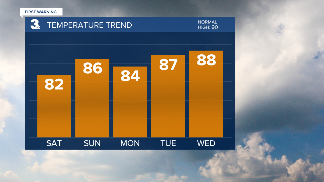
Get ready for a stormy start to the weekend with a highs in the low 80s. We've got chance of strong to severe storms, so keep an eye on the sky and be prepared for damaging winds and flooding rainfall. Most of the area is under a level 1 for severe storms.

Things calm down a bit on Sunday with highs in the mid 80s. We'll see hit-or-miss storms with a 40% chance, meaning some areas might stay dry while others get a good soaking.
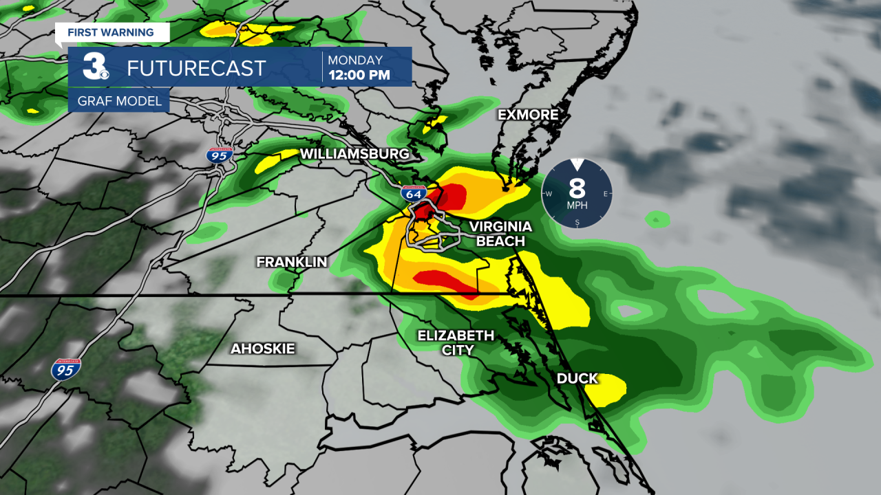
Storms are likely as we kick off the workweek, with highs in the low and mid 80s. Keep that umbrella handy and plan for a wet commute.
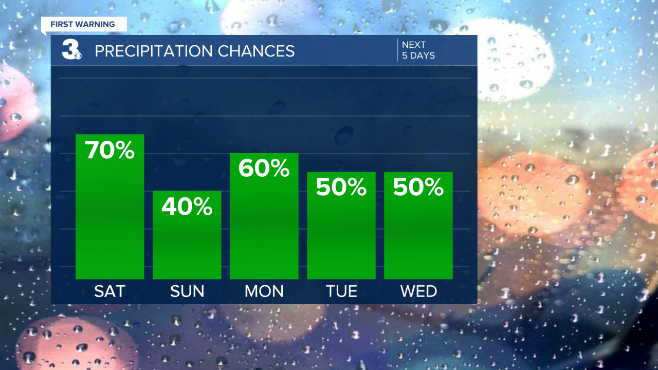
Scattered storms continue on Tuesday. Expect periods of rain and thunder throughout the day.
The stormy pattern persists with another 50/50 shot of showers and storms. It will be warm and humid with highs in the upper 80s.
Periods of showers and storms will be possible on both Thursday and Friday. It will continue to be muggy with highs in the low and mid 80s.

Meteorologist April Loveland
For weather updates on Facebook: HERE
Follow me on Twitter: HERE
Follow me on Instagram HERE
Check out the Interactive Radar on WTKR.com: Interactive Radar
