


Chief Meteorologist Patrick Rockey's First Warning Forecast
After a powerful cold front crosses our region Tuesday night, we will enjoy a brief break from the worst of the summer heat and humidity.
But never fear it will come roaring back as we head into the long holiday weekend.
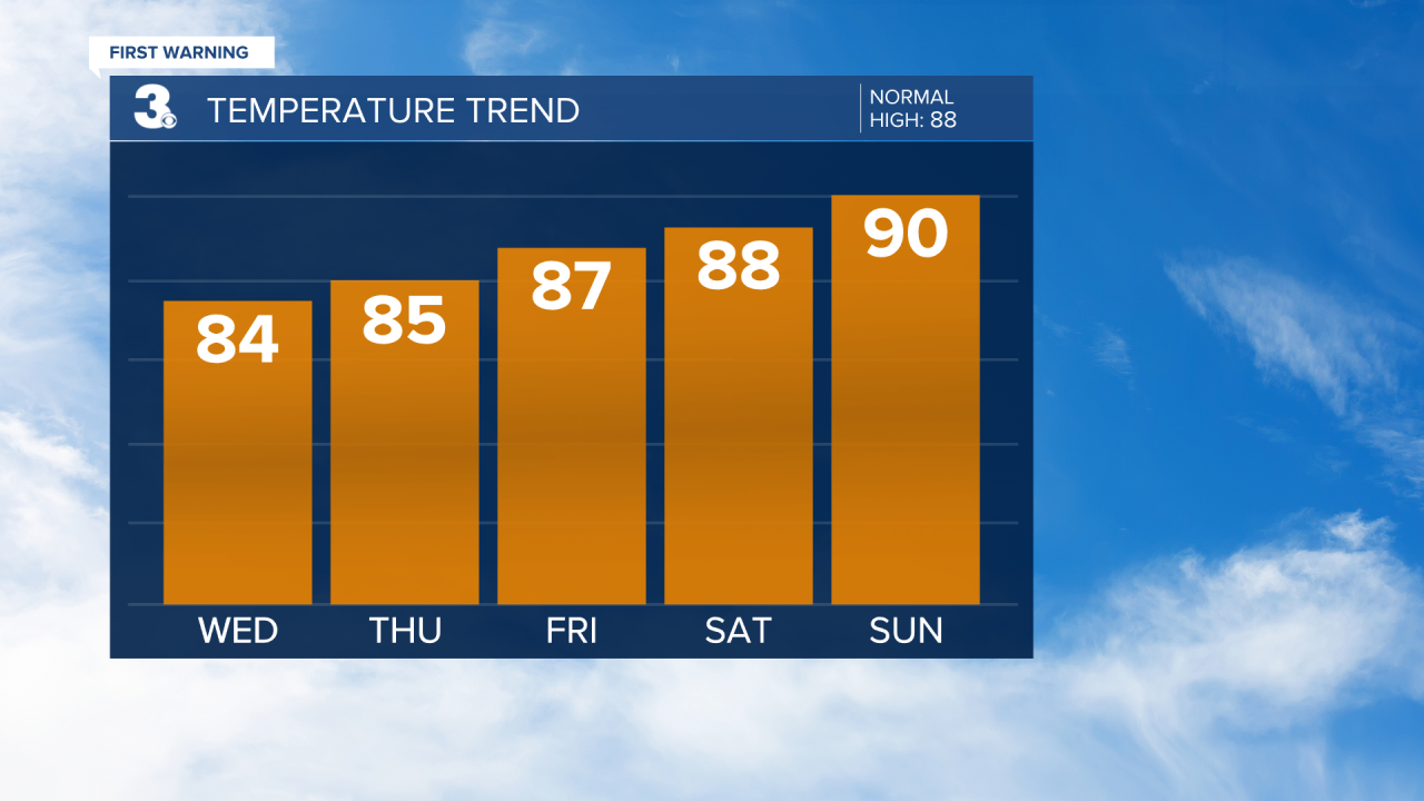
Your Friday will be slightly more humid, and a little warmer with just a slight chance for a late afternoon or evening storm.
Storm chances go up a bit along with the temperature on Saturday. Most of us will top out in the mid to upper 80s with a 30% chance for storms.
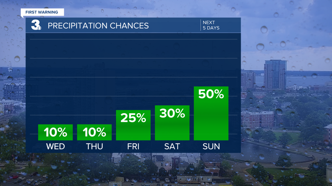
The warming trend continues on Sunday with high temperatures near 90° and a 50% chance for a cooling afternoon and evening storm.
Monday is looking slightly less hot and slightly less stormy. We are expecting a 40% chance for storms with partly cloudy skies.
The heat and humidity return just in time for the big holiday on Tuesday.
Your Fourth of July will feature high temperatures near 90° and maybe a few fireworks for Mother Nature. We are expecting a 40% chance for afternoon and evening storms. Be safe.
