

Meteorologist April Loveland's First Warning Forecast
A Tornado Watch is in effect until 8 PM.
A Watch means, BE PREPARED! Tornadoes are possible in and near the watch area.


A strong cold front will approach today bringing the chance for strong to severe storms. Most of the area is under a Level 2 out of 5. That means scattered severe storms will be possible.

The biggest threat will be damaging wind gusts. Other threats include, flooding rainfall and isolated tornadoes.

The window for severe storms will be after 6 PM, but storms will be possible well before then.


The heavy rain could cause flash flooding, especially in urban areas. We could see 2 to 3 inches of rain from this storm system.
It will be windy with winds out of the south and southwest at 15-25 mph, with gusts up to 40 mph possible. The highest gusts will occur along the coast.

As the cold front moves through, winds will switch to the northwest. This will bring in some much colder air. A brief changeover to snow is possible. The best chance will be to the west and north of James City County. We will keep an eye on this.
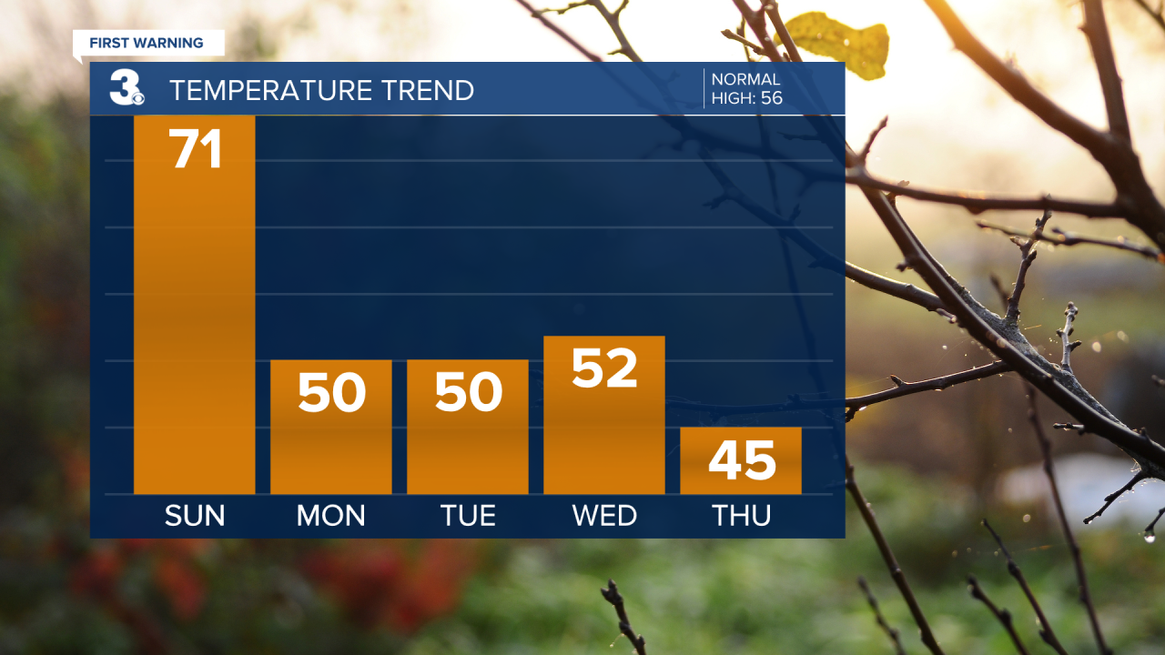
A few lingering showers and storms will be possible early Monday, with drying conditions and partial clearing after 5 AM. Temperatures will be much cooler, with highs around 50 degrees. It will be windy and chilly. Winds will be out of the northwest at 15-25 mph, with gusts up to 35 mph possible.
A dry stretch of weather will continue for the rest of the week. Plenty of sunshine on Tuesday with highs near 50. A few more clouds will build in on Wednesday with highs in the low 50s. Thursday will be sunny and cold with highs in the mid and upper 40s. A few degrees milder to end the work week. Expect mostly sunny skies and highs in the low 50s.
The next storm system looks to move in for the second half of next weekend.
Meteorologist April Loveland
For weather updates on Facebook: HERE
Follow me on Twitter: HERE
Follow me on Instagram HERE
Check out the Interactive Radar on WTKR.com: Interactive Radar
