


Meteorologist April Loveland's First Warning Forecast
**Heat Advisory in effect until 7 PM
Heat index values up to 106° possible.

Happy weekend everyone!
Expect storms and heat on this Saturday. Temperatures will soar to the low 90s, but it will feel closer to the triple digits once we factor in the humidity. It will also be a bit breezy. Winds will be out of the southwest at 10-15 mph. Gusts up to 20 mph possible. Be sure to stay hydrated if you're going to be out and about! It's not only going to be hot, but we have the threat to see some strong to severe storms by the afternoon and evening.
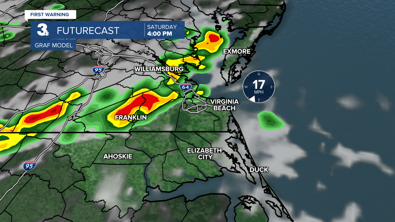
The area is under a level 1 and level 2 threat of severe storms. The biggest threats will be damaging wind gusts and flooding rainfall.

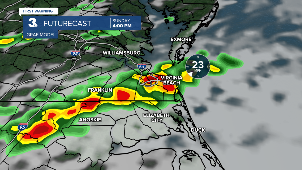
Sunday won't be as hot. Expect highs in the mid and upper 80s. Storms will be possible once again by the afternoon and evening. It will also be a bit breezy with winds out of the southwest at 10-15 mph, with gusts up to 25 mph possible.
A few spotty showers or storms will be possible to kick off the work week. Highs will soar to 90.
A spotty storm will be possible again on Tuesday, but most of the area should stay dry. Highs will top out in the low 80s.
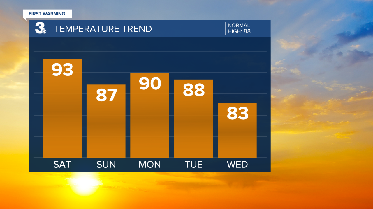
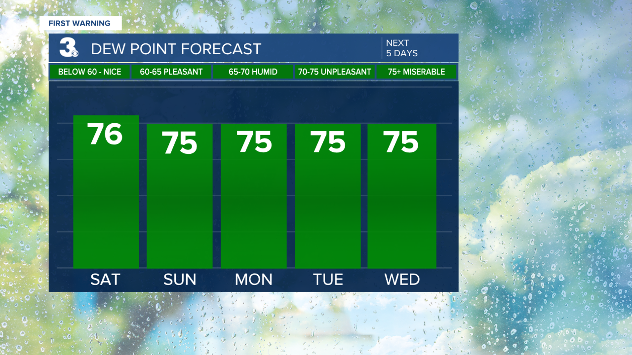
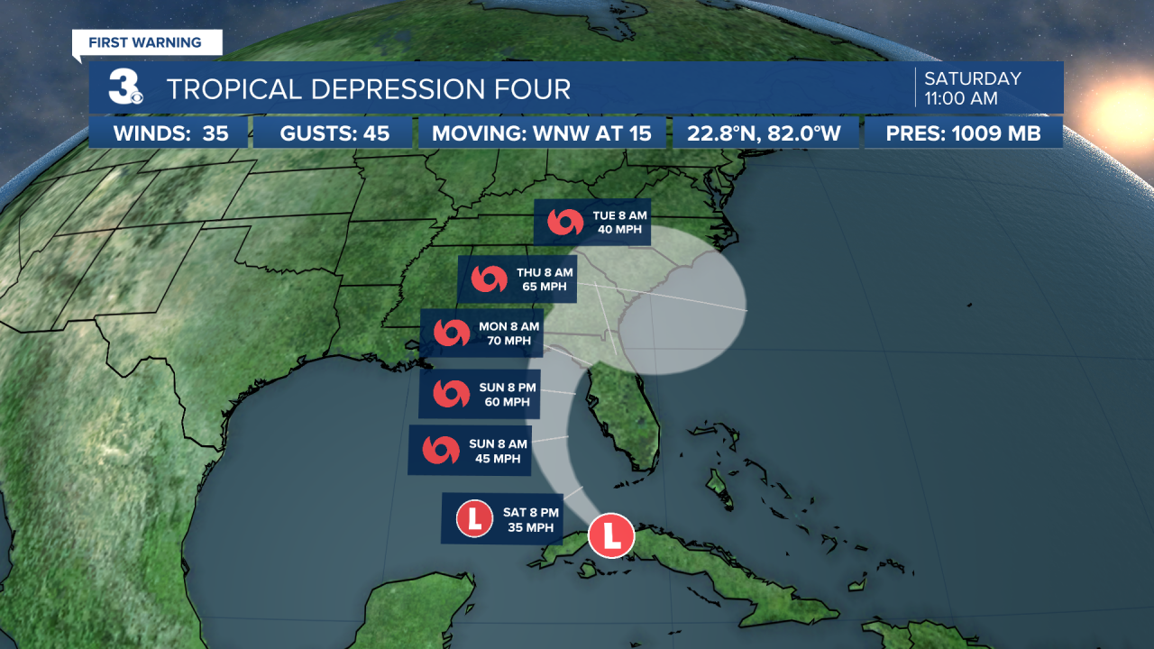
We could potentially see some tropical moisture from what will eventually become Tropical Storm Debby. Right now, there is a lot of uncertainty. The frontal system that brought storms over the weekend will be stalled over the area and will basically dictate where this tropical storm tracks. Will keep chances for showers and storms Wednesday through Friday. Temperatures will trend below-normal with highs in the low 80s, but it will still be very humid. Stay tuned for any updates!
Tropical Update:
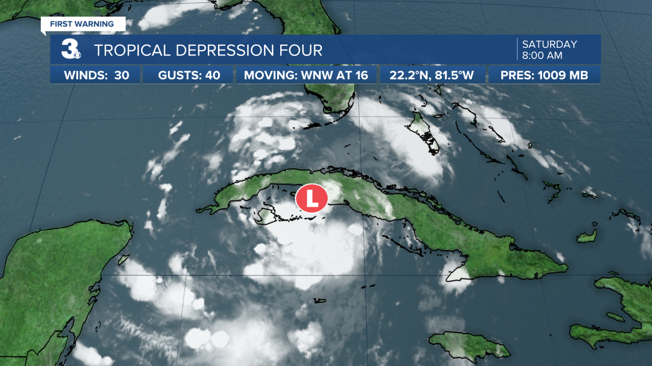
1 AM: The Depression is located about 125 miles south of Key West Florida.
We could see the system strengthen tonight. It would become Tropical Storm Debby.
This has the potential to be a big rainmaker for Georgia, the Carolinas and maybe even Virginia. If you look at the track, you'll see the end is just a big circle. That means the storm is expected to stall, which is never a good thing! There is still a lot of uncertainty with this system, but it looks like we will be watching it and potentially dealing with it through next weekend.
Meteorologist April Loveland
For weather updates on Facebook: HERE
Follow me on Twitter: HERE
Follow me on Instagram HERE
Check out the Interactive Radar on WTKR.com: Interactive Radar
