Meteorologist Kristy Steward's First Warning Forecast
Happy Wednesday evening! We had a little taste of summer today with highs reaching the mid 80s! Warmth continues for one more day before a cold front brings us potentially severe storms and a big cool down.
Tonight, clouds will increase ahead of that cold front. Temperatures stay warm with lows in the mid 60s. There could be some patchy fog developing late tonight into early Thursday morning.
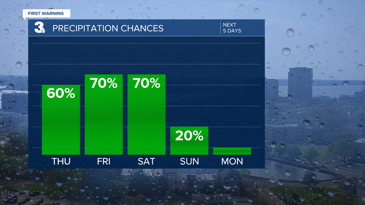
Thursday will be another warm day in the mid 80s. Much of the daytime hours will be dry. A line of storms will enter our inland communities and the peninsulas around 6 PM. This line will continue to slowly move east. Within the line, we could have severe storms.

Almost everyone is under a level 1 of 5 risk for severe storms. Damaging winds are the primary threat, but larger hail is also possible. The severe threat should end by Midnight.

After the severe threat is over, scattered rain will still continue for Friday and Saturday. Behind the cold front, temperatures will drop to highs in the mid 50s Friday and low 50s Saturday. Winds will be stronger both days too.
Fortunately, the rain should clear out by Easter Sunday. Easter will be partly cloudy and a little warmer. Highs in the mid to upper 50s, but still windy.

The first half of the workweek we’ll be under the influence of high pressure. That will bring us lots of sunshine and a warming trend. Highs in the low 60s Monday rise to 70° Wednesday.
Connect with Meteorologist Kristy Steward:
FACEBOOK
TWITTER
INSTAGRAM


