


Chief Meteorologist Patrick Rockey's First Warning Forecast
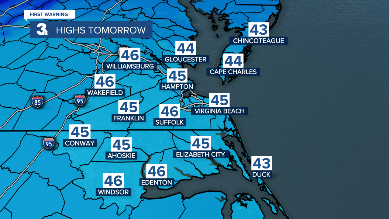
Get ready to go from falling rain to falling temperatures, as a cold front moves in behind our coastal storm.
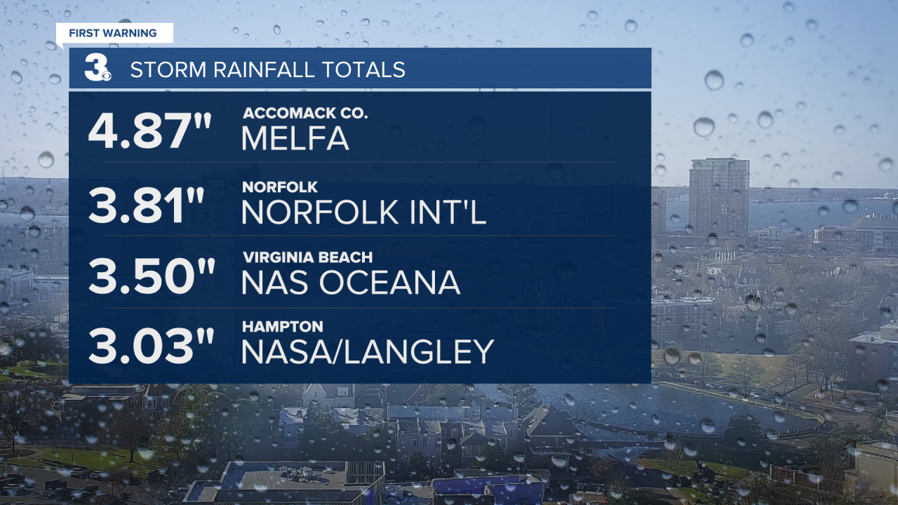
Sunday's storm system brought a drought-busting 3-5 inches of rain in most areas. With the highest totals on the Virginia Eastern Shore.

As of last week, Accomack and Northampton Counties were in a severe drought. The rain that fell Sunday and Monday will go a long way in pulling us out.
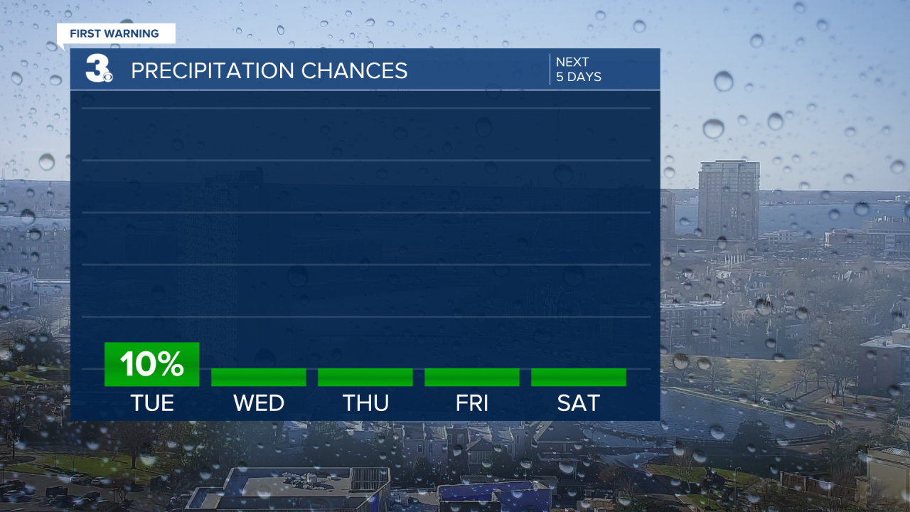
And now it looks like we're going to turn off the tap for awhile. There's just a slight chance for a stray raindrop (or snowflake) overnight as a strong cold front pushes through. After that, our rain chances stay pretty much non-existant until we get to Christmas Day, next Monday.

Behind that cold front, our high temperatures on Tuesday will be about 20 degrees cooler than Monday. And the winds will stay pretty breezy, making it feel even colder.
We do see a warming trend developing as we head into next week. And that's bad news for those of you hoping for a White Christmas. At this point, wet is looking more likely than white. Stay tuned.
