Chief Meteorologist Patrick Rockey's First Warning Forecast
The center of hurricane Ian may be nearly a thousand miles from our area, but we are already starting to see some of its clouds in our sky. And that is only the beginning of what promises to be a long visit from Ian.
Clouds will continue to increase as we head through the day on Wednesday, but we are not expecting any rain. It will be a very comfortable day with high temperatures in the lower 70s.

The clouds will continue to thicken and lower on Thursday, and some forecast models do bring in some showers late in the day. Right now we are holding at a 20% chance for rain with high temperatures in the upper 60s.

Winds will begin to increase on Thursday. They will be out of the north northeast at 15 to 25 mph. And those persistent onshore winds through the weekend and into early next week will bring us the threat of flooding at times of high tide.
We are looking at the possibility of minor-to-moderate tidal flooding, especially Sunday and Monday.

We expect Ian will bring us rain beginning on Friday with heavy downpours possible Saturday and into Sunday.
More showers will be with us on Monday, but should start to wrap up by Tuesday morning.

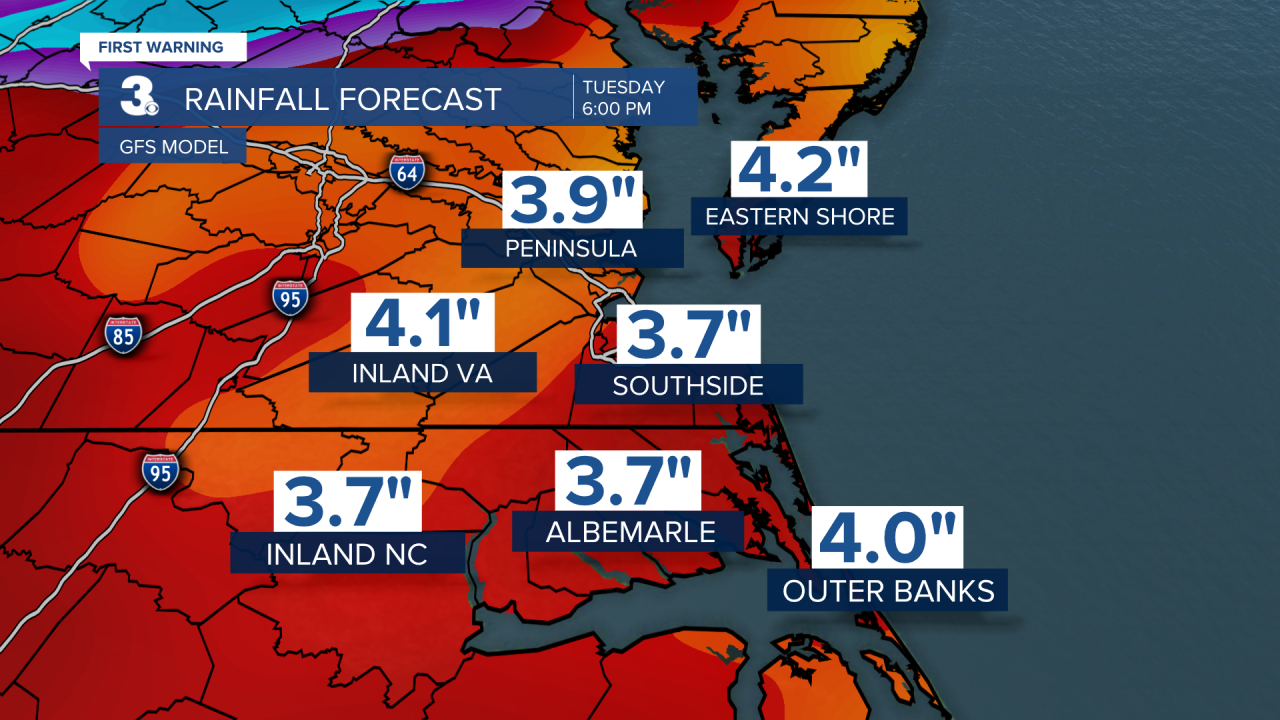
By the time, the remnants of Ian have cleared our region, our main forecast models are painting in 3 to 5 inches of rain.


