

Meteorologist April Loveland's First Warning Forecast
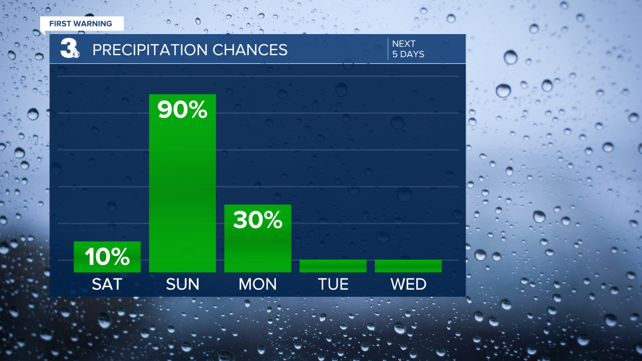
Today will be the pick day of the weekend. Expect a nice mix of sun and clouds with highs in the mid and upper 60s. A few low 70s will be possible in North Carolina. Very mild for this time of year. If may be a good time to tie down or bring in any loose holiday decorations. We've got a strong storm system that is set to impact the area on Sunday.

A few showers will be possible Sunday morning with better chances for showers and storms by the afternoon. The entire area in under a level 1 for isolated severe storms.


The biggest threat will be damaging wind gusts. A little lower on the scale, but still possible, heavy rain, large hail and isolated tornadoes. The best chance to see strong to severe storms will be after 6 PM.

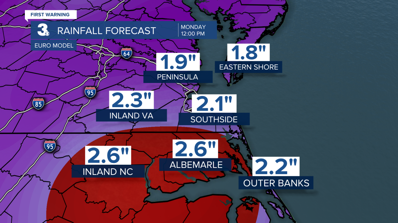
The heavy rain could cause some minor flooding. We could see 2 to 3 inches of rain from this storm system.
A few lingering showers and storms will be possible early Monday, with drying conditions and partial clearing by 7 AM. Temperatures will be much cooler, with highs around 50 degrees. It will be windy and chilly.
A dry stretch of weather will continue through the rest of the week. Plenty of sunshine on Tuesday with highs near 50. A few more clouds will build in on Wednesday with highs in the low 50s. Thursday will be sunny and cold with highs in the upper 40s. A few degrees milder to end the work week. Expect mostly sunny skies and highs in the low 50s.
Meteorologist April Loveland
For weather updates on Facebook: HERE
Follow me on Twitter: HERE
Follow me on Instagram HERE
Check out the Interactive Radar on WTKR.com: Interactive Radar
