


Chief Meteorologist Patrick Rockey's First Warning Forecast
As if you already don’t look forward to the weekend, we are tracking a breath of fresh air — Lower temperatures and lower humidity are on the way (at least for a few days).
A strong cold front will cross the region Friday evening, ushering in the milder weekend weather.
It will still be a bit humid when you wake up on Saturday morning, but the drier air will push in by the afternoon.

Expect high temperatures in the mid 80s under partly cloudy skies on Saturday. A stray shower or thunderstorm is not out of the question. But most of us should stay dry.
It will be a few degrees warmer on Sunday, but still very pleasant. And our rain chances will be even lower.
Rain chances go up a bit as we head into the work week. On Monday and Tuesday we have a 25% chance for a spotty shower or thunderstorm.
Temperatures will remain a little below normal, but humidity levels will start to rise, especially on Tuesday.
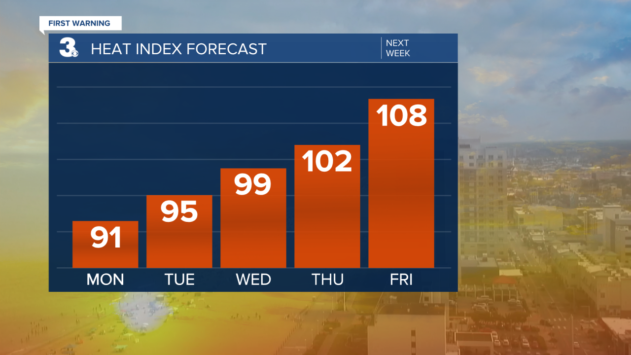
And that trend will stay with us through the work week. By Wednesday, our feels like temperatures will be approaching 100°. It looks like we will cross the century mark on Thursday and by Friday some of us could hit 110° with our heat index. Proof that it is still July!

And the longer-range forecast for August from the Climate Prediction Center shows that summer is far from over.
Stay tuned.
