


Meteorologist Kristy Steward's First Warning Forecast
Happy Saturday morning! A cold front is headed our way and will get stuck over the top of us. While we will see cooler temperatures, humidity stays high and rain chances increase.
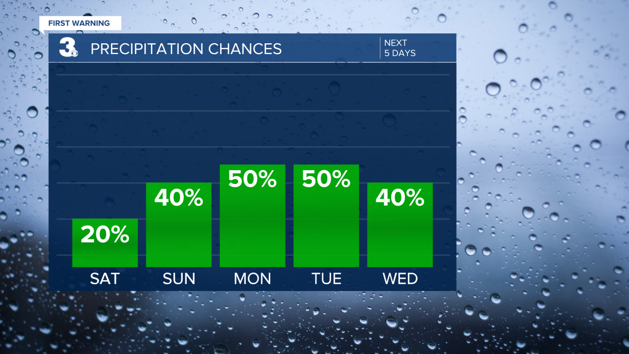
Saturday will be another hot day with highs in the upper 80s, feeling like the upper 90s. Most of the day will be dry, just a few spotty showers here and there. The cold front moves through tonight and stalls over the top of us. This kicks off our unsettled stretch and it’ll be time to dust off the umbrellas again.

Behind the cold front, high temperatures will drop into the low to mid 80s and stay there for most of next week. Humidity stays on the higher side, making it feel like the upper 80s to low 90s each day. We’ll also have daily storm chances. Not a washout, but off and on rounds of storms with greater chances each afternoon and evening.
We do have a level 1 of 5 severe risk in effect for our North Carolina communities Sunday afternoon and evening. Damaging wind gusts are the primary threat.

Late next week, temperatures look to cool down a few more degrees to the upper 70s and low 80s, but rain chances still remain as we’ll likely have a tropical low pressure system riding up the East Coast.
Connect with Meteorologist Kristy Steward:
FACEBOOK
TWITTER
INSTAGRAM
