


Meteorologist Kristy Steward's First Warning Forecast
Happy Sunday morning! It’s looking like a decent end to our weekend, but a rough start to the workweek with high heat and severe storms.
A few showers moving across the peninsulas this morning is the majority of the rain we’ll see today. Sunday is shaping up to be a mostly dry day with lots of sunshine. Temperatures will be a little warmer in the upper 80s, but humidity will still be on the lower side. Heat index values will only be around 90°.
Temperatures really soar Monday. Highs in the low to mid 90s with a surge in humidity making it feel 100-105° outside. After 5 PM, lines of storms will likely develop and move through.
Some of these storms could become strong to severe. Most of the area is under a level 1 of 5 risk for severe storms. A level 2 risk for our western edge.

There is a very tight gradient between the level 1 and 3 risk categories and storms don’t stay confined to these lines, so be weather aware starting 5 PM Monday into the night. Damaging wind gusts and heavy downpours leading to localized flash flooding are the primary threats.

We should dry out by Tuesday morning and clouds will clear out. Temperatures still remain steamy in the low 90s, feeling like 100°. A cold front Tuesday night brings us brief relief for Wednesday.
It’s a dry cold front, so no rain is expected, but it will drop temperatures a couple degrees to highs in the upper 80s Wednesday. Even better, the dew points will drop into the mid 60s, so you won’t really feel any humidity.
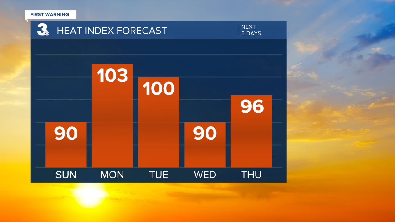
Enjoy this break Wednesday because temperatures return to the low 90s the rest of the week with surging dew points making it feel like the upper 90s. Isolated to scattered storm chances daily from Thursday into the weekend.
Connect with Meteorologist Kristy Steward:
FACEBOOK
TWITTER
INSTAGRAM
