


Meteorologist Kristy Steward's First Warning Forecast
Happy Wednesday evening! Temperatures were 15 degrees cooler today than yesterday. We’ll make a 15 degree jump before a cold front knocks our temperatures down for a while and brings us some rain.
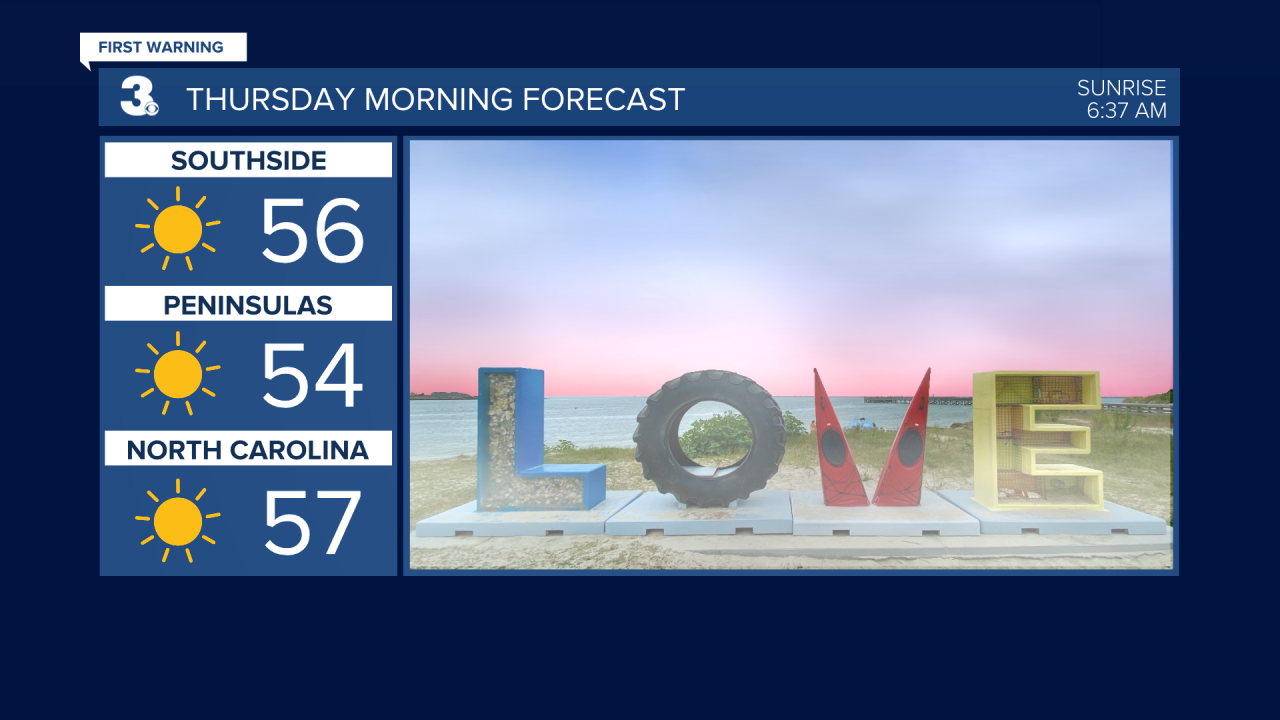
Late tonight, patchy fog could develop and impact your Thursday morning commute. We’ll wake up to temperatures in the mid 50s.
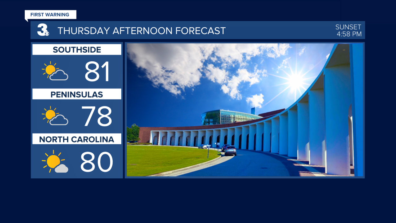
Throughout the day Thursday, a warm front will lift north and breezy southwest winds will help temperatures soar to 80°. Clouds will also increase as the day goes on and we could have a few spotty evening showers in our northern communities.
Friday will be a gloomy day with lots of cloud cover and afternoon/evening scattered light rain showers. Temperatures will be much cooler with highs in the low 60s.
We dry out in time for Veterans Day, so celebrations should be pleasant. It will be cooler on Saturday waking up to temperatures in the mid 40s and warming into the upper 50s. A few lingering spotty showers can’t be ruled out.
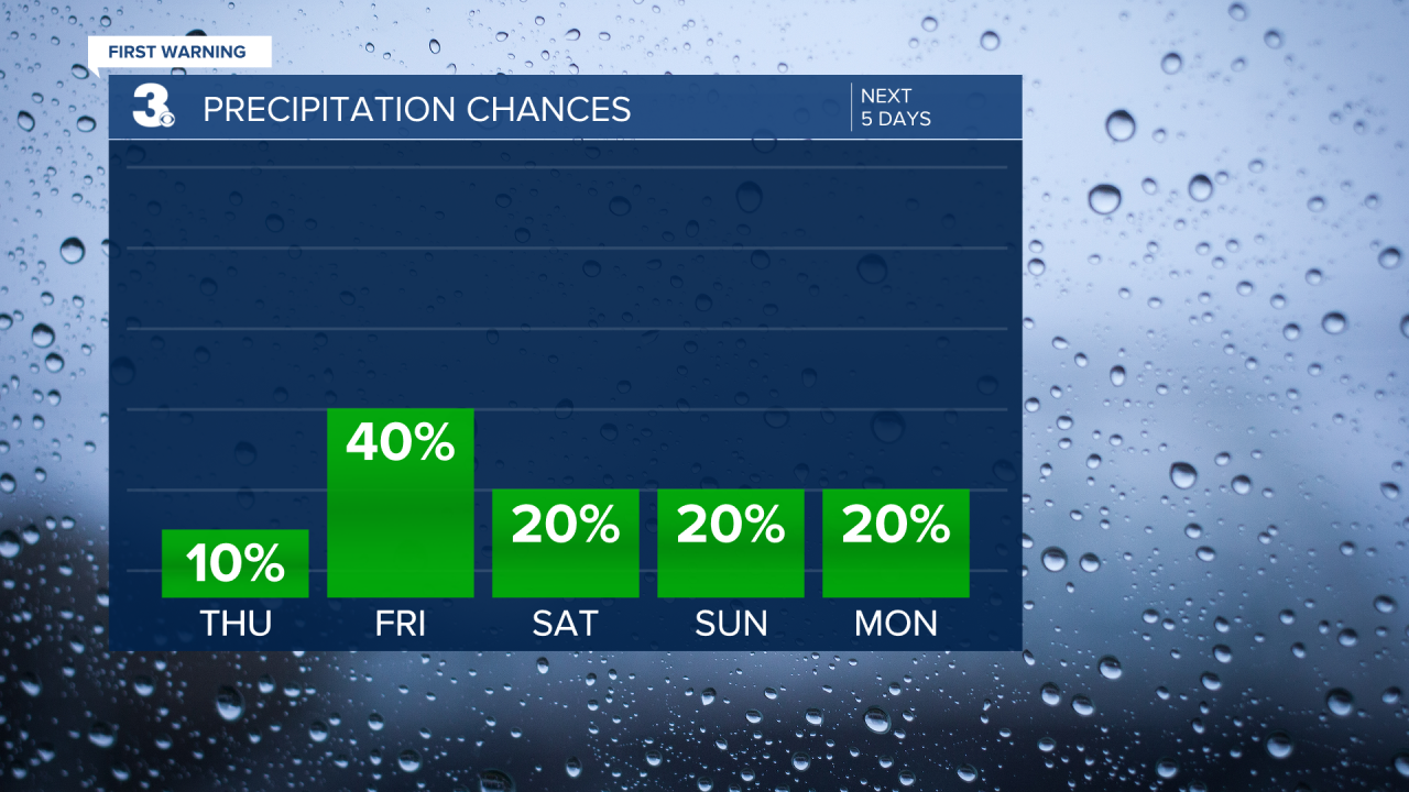
Similar weather continues Sunday. Mostly dry with highs in the mid 50s.

The first half of the work week looks dry with below-average temperatures remaining. Highs in the mid 50s Monday gradually warms a handful of degrees into the low 60s Wednesday.
Connect with Meteorologist Kristy Steward:
FACEBOOK
TWITTER
INSTAGRAM
