


Meteorologist Kristy Steward's First Warning Forecast
Happy Saturday evening! We had some scattered showers along a cold front that passed through earlier today. Now, we’re dry, breezy and cooling down!
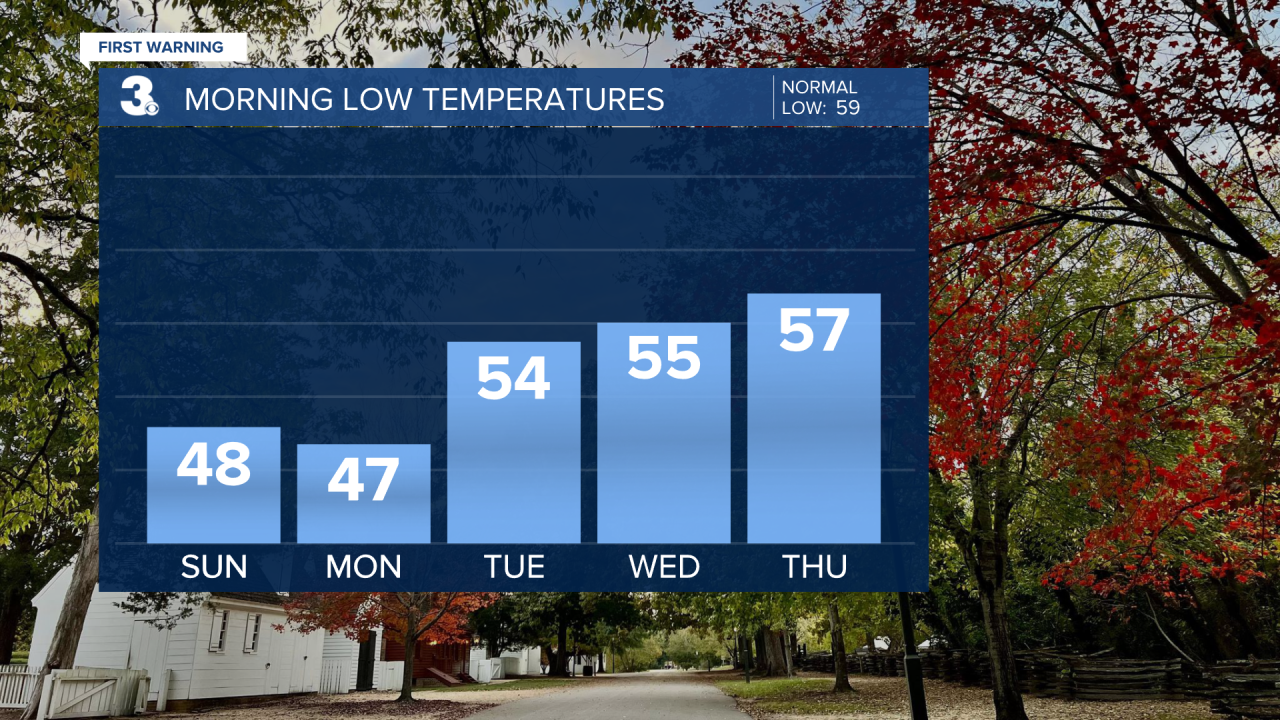
Overnight lows tonight will drop into the upper 40s under a mostly clear sky. Time to break out those thicker jackets! Sunday will stay breezy and cool with highs only reaching the mid 60s. Lows Sunday night drop into the mid to upper 40s again. So, a chilly start to the workweek.
At least there will be tons of sunshine Sunday and that sunshine sticks around for most of the workweek. This sun will help temperatures gradually rise. Highs on Monday will be in the low 70s warming to the more seasonable mid to upper 70s the rest of the week.

Cloud cover increases late in the week ahead of an approaching system that could bring us rain showers Friday and Saturday. The timing of the rain still has a good amount of uncertainty associated with it. We’ll get a better idea once this system forms out west and starts heading our direction. Stay tuned!
Connect with Meteorologist Kristy Steward:
FACEBOOK
TWITTER
INSTAGRAM
