

Meteorologist April Loveland's First Warning Forecast
Plenty of sunshine on tap Thursday. Highs will trend in the mid 80s. Skies will be partly to mostly sunny. Humidity will still be on the lower side.

Finally, Friday wraps up with partly cloudy skies. Temperatures will hold steady in the mid 80s.
The humidity will be on the rise just in time for the weekend.

Temperatures will warm to the mid 80s on Saturday with a slight chance of a spotty storm. A little bit better of a chance on Sunday with highs in the upper 80s.

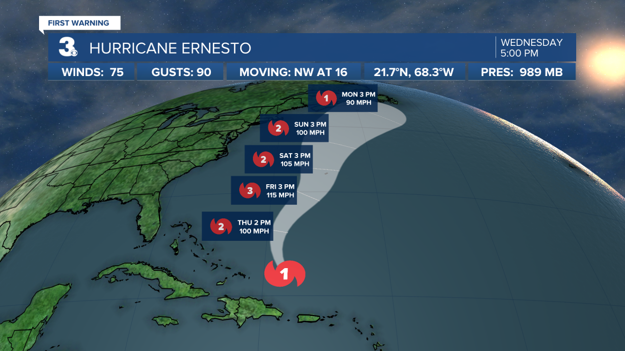
Even though Hurricane Ernesto will be well offshore, rip currents will be an issue heading into the weekend.

The unsettled weather will continue into Monday. Expect chances for storms and highs in the mid 80s.
A few degrees cooler on Tuesday and Wednesday. Highs will be in the low 80s under partly cloudy skies.
Meteorologist April Loveland
For weather updates on Facebook: HERE
Follow me on Twitter: HERE
Follow me on Instagram HERE
Check out the Interactive Radar on WTKR.com: Interactive Radar
