


Meteorologist Myles Henderson’s First Warning Forecast
Comfortable temperatures with highs in the 70s this week. Tracking showers and storms for the weekend.
A step warmer today with highs in the upper 70s. We will see a nice mix of sun and clouds with slim rain chances.

Another nice day tomorrow with more sunshine in the morning and building clouds through the afternoon. Highs in the mid 70s tomorrow.
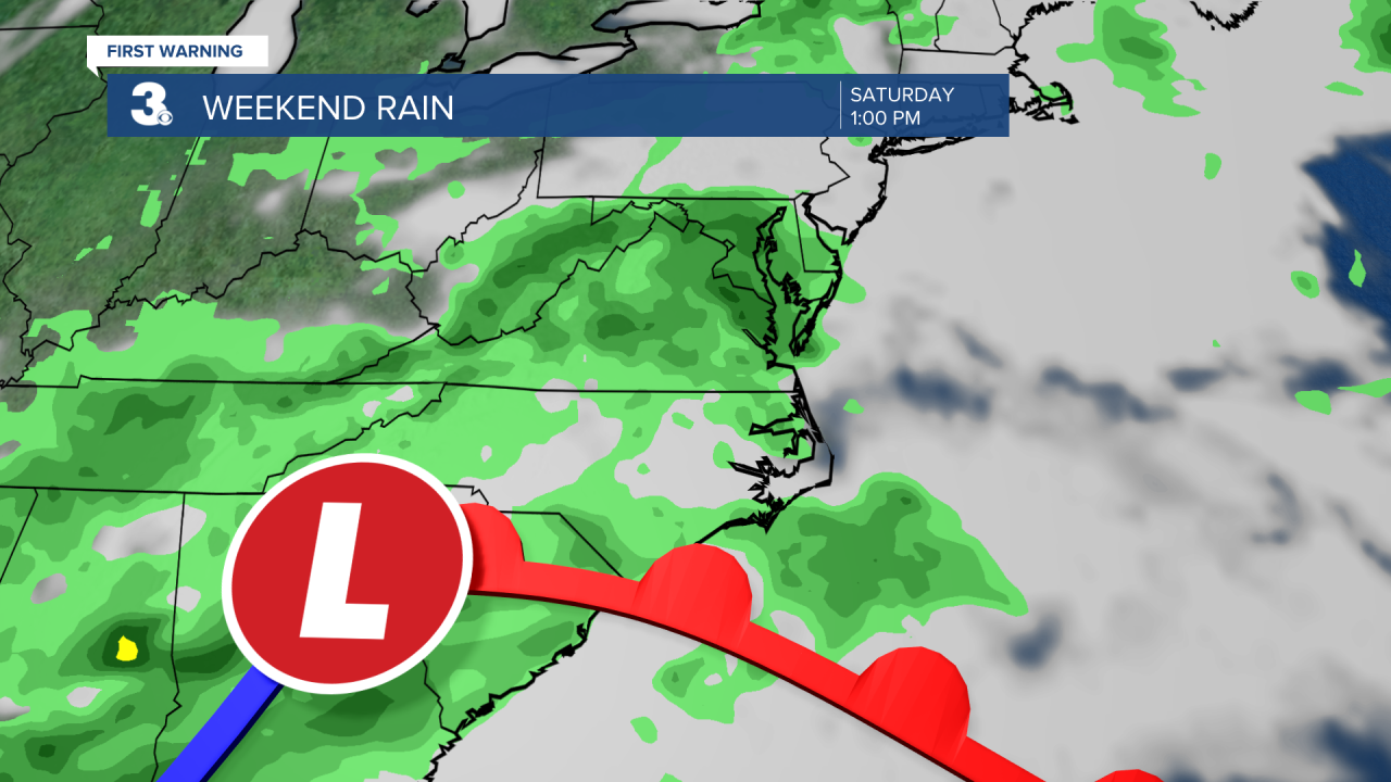
Rain returns this weekend as an area of low pressure tracks across the Mid-Atlantic. Expect scattered showers and storms for Saturday and Sunday with mostly cloudy skies. Highs will drop to the low 70s this weekend. The wind will ramp up for Sunday, NE at 10 to 20 with gusts to 30 mph.
Today: Partly Cloudy. Highs in the upper 70s. Winds: N 10-15
Tonight: Partly Cloudy. Lows in the low 60s. Winds: N 5-10
Tomorrow: Building Clouds. Highs in the mid 70s. Winds: N/E 5-10
Weather & Health
Pollen: Mod-High (Grasses, Oak, Mulberry)
UV Index: 8 (High)
Air Quality: Good (Code Green)
Mosquitoes: Moderate

Weather updates on social media:
Facebook: MylesHendersonWTKR
Instagram: @MylesHendersonWTKR
X (Twitter): @MHendersonWTKR
