
Derrah Getter's First Warning Forecast
A coastal low will be moving along the east coast causing widespread rain chances. We're monitoring this system for potential tropical development.
Sunday will feature brighter skies. It will be humid but the breezy conditions will help make it feel more comfortable. Highs will make a run for the low 80s. There will be the chance for a few isolated showers mainly for portions of northeast North Carolina.

Starting Monday, scattered showers and storms move in. The elevated rain chances stick around all weak long. Models are coming into better agreement as to how much rain we'll see. You can expect up to 3 inches with most spots racking up 2 inches.
Highs during this next stretch will be in the upper 70s and low 80s. It will be pretty muggy but the cloud cover and breezy conditions will help ease conditions and make it feel more mild.

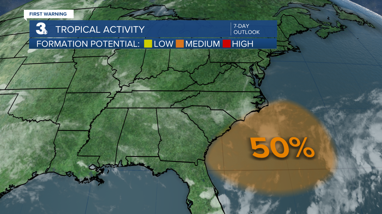
Tropical Update
As of 9/14/24 at 10 pm
Offshore southeastern U.S.:
A non-tropical area of low pressure is expected to form within the next day or so off the southeastern U.S. coastline. Some subtropical or tropical development is possible during the early part of next week while the system drifts off to the northwest.
Formation chance through 48 hours...MEDIUM (50%)
Formation chance through 7 days...MEDIUM (50%)
Let's connect on social media!
Forecaster Derrah Getter:
For weather updates on Facebook: HERE
For weather updates on Twitter: HERE
Follow me on Instagram: HERE
Check out the Interactive Radar on WTKR.com: Interactive Radar
