


Meteorologist Kristy Steward's First Warning Forecast
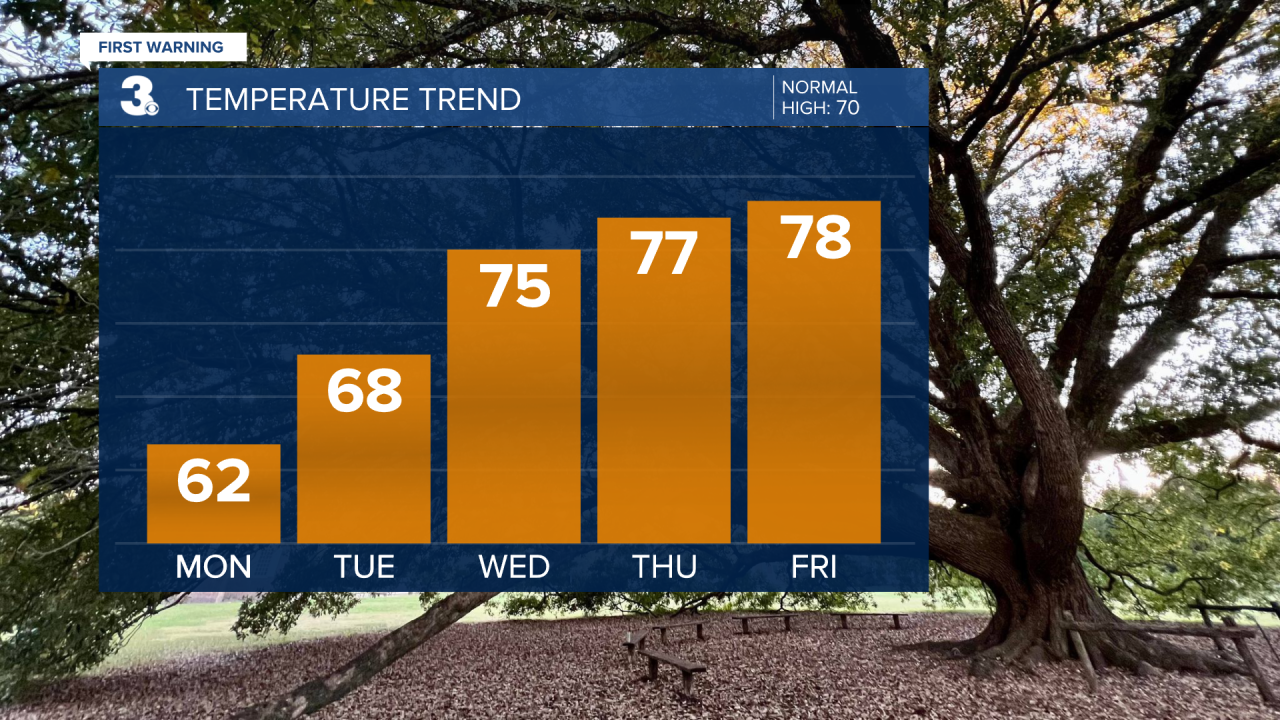
Happy Sunday evening! We have a drop in temperatures to start the workweek, but then temperatures will be on the rebound, climbing to near 80° later in the week.
High pressure has settled in and is making itself comfortable. It will keep us in a dry and sunny stretch all week long, but also bring us variable temperatures throughout the week.

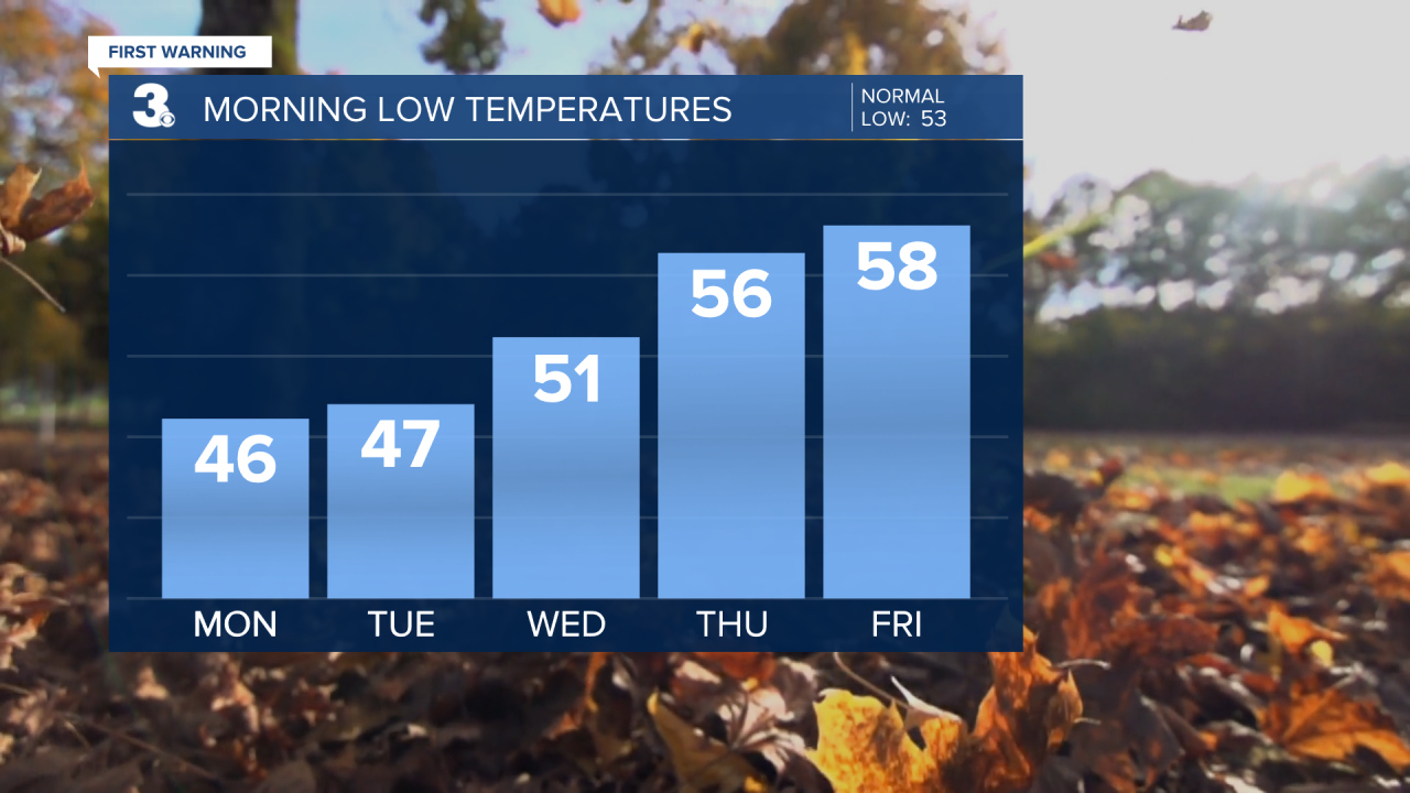
Everyday will feature lots of sunshine. We start off the workweek with temperatures in the low to mid 40s Monday morning, warming up to the low 60s Monday afternoon.
Temperatures in the morning and afternoon gradually warm up each day as the week goes on. Highs in the upper 60s Tuesday rise to the mid 70s Wednesday and upper 70 to end the workweek and kick off the weekend.
Morning lows will be in the mid 40s Tuesday gradually warming into the upper 50s for the second half of the week.
Connect with Meteorologist Kristy Steward:
FACEBOOK
TWITTER
INSTAGRAM
