


Meteorologist April Loveland's First Warning Forecast
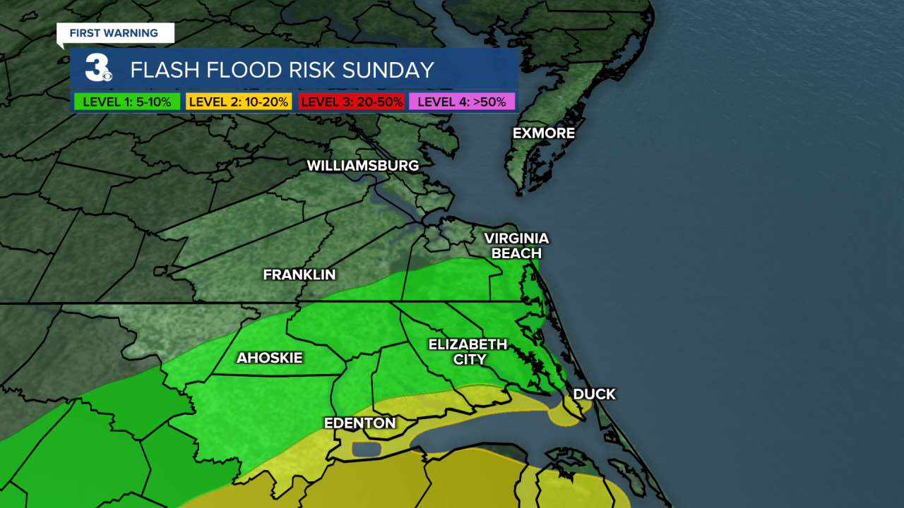
For today, expect scattered showers and storms this afternoon and evening. There is a risk of flash flooding over areas that have already seen quite a bit of rainfall.
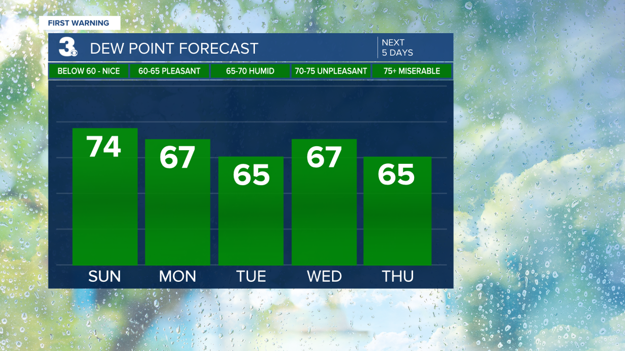
Temperatures cool off slightly to the low and mid 80s. It will still be on the humid side, but not quite as bad as Saturday.
By Monday, things start to clear up with partly cloudy skies and drier conditions. Temperatures will stay below normal, with highs in the low 80s.
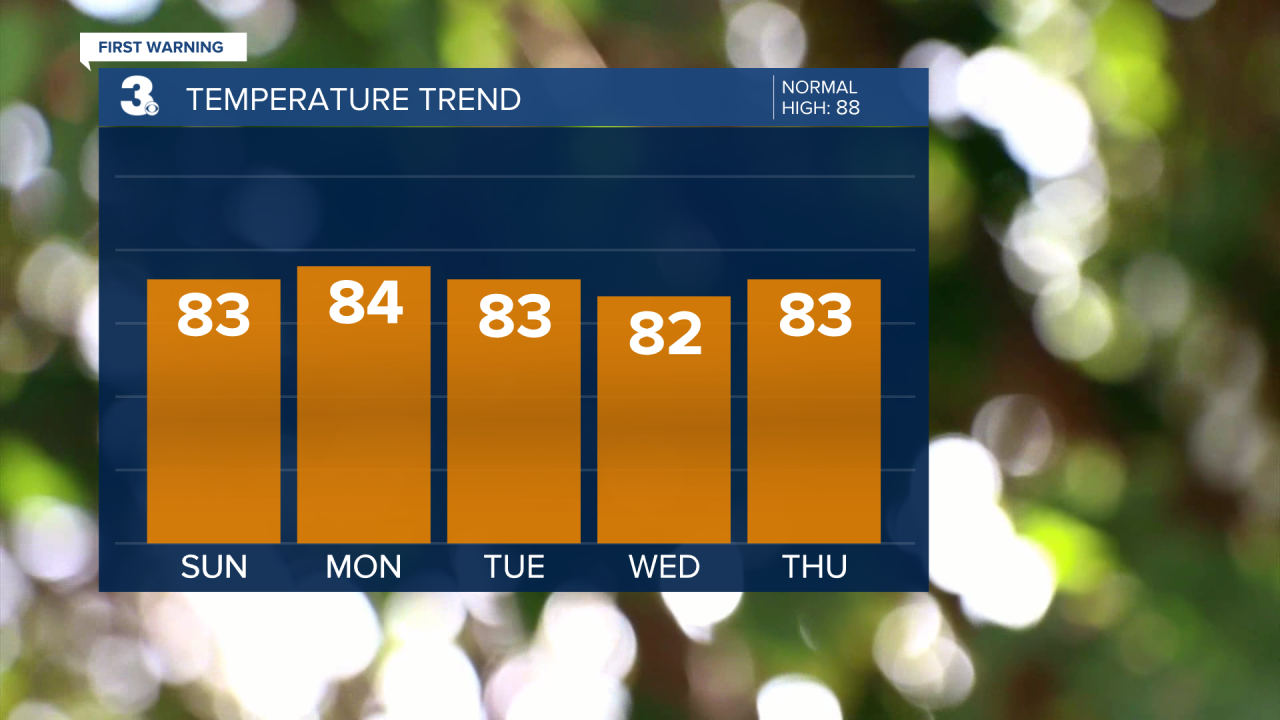
Skies will be partly cloudy once again on Tuesday with highs in the low 80s.
Wednesday brings more spotty storms. High temperatures will remain in the low 80s with pretty comfortable humidity levels. Expect mostly sunny skies on Thursday. Highs will trend in the low and mid 80s.
Finally, Friday wraps up the week with plenty of sunshine. Temperatures will hold steady in the low 80s.
A few showers will be possible by the weekend.
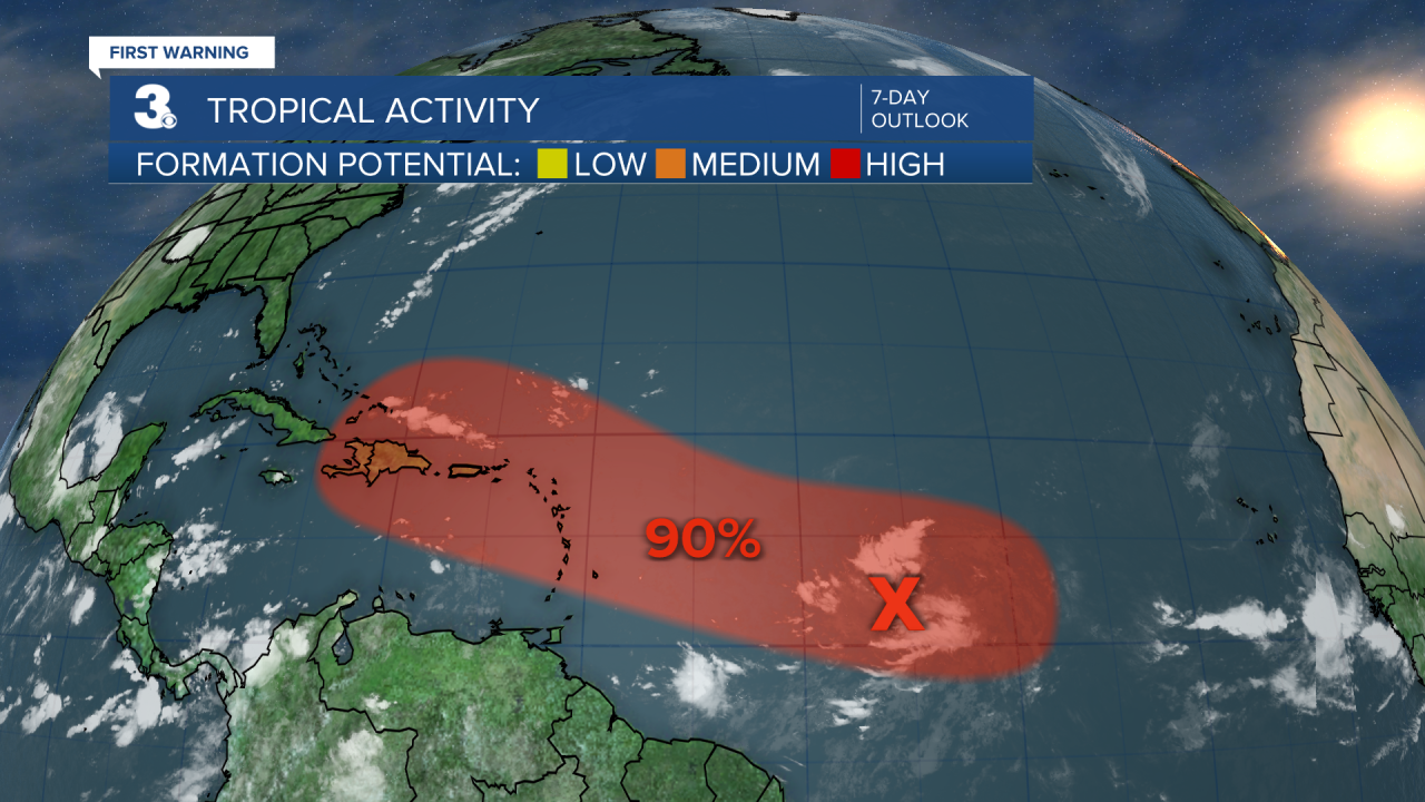
Tropical Update:
Meteorologist April Loveland
For weather updates on Facebook: HERE
Follow me on Twitter: HERE
Follow me on Instagram HERE
Check out the Interactive Radar on WTKR.com: Interactive Radar
