Chief Meteorologist Patrick Rockey's First Warning Forecast
Good news and bad news weather wise.
The good news: lower humidity and lower temperatures are on the way.
The bad news: first we have to get through the threat for strong-to-severe storms as a powerful cold front pushes through the region.
That front will be crossing the area late Monday evening and into early on Tuesday.
As it moves through, we could see a few storms producing damaging wind gusts that could be an excess of 60 mph. That is our number one concern.

However, we could also see some large hail and even an isolated tornado is not out of the question.
The storms should be gone by the time you wake up on Tuesday morning. However, you may run into some areas of dense fog on the trip to work.

By the time you are heading home from work on Tuesday you will start to notice the effects of that cold front.
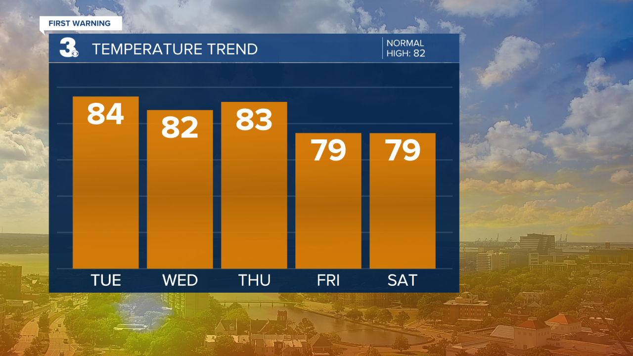
Humidity levels will be dropping in the afternoon. And throughout the work week we will enjoy lower temperatures and especially lower humidity.

Expect highs near normal in the low-to-mid 80s Tuesday through Thursday.
And many of us may not even get out of the 70s with lots of sunshine on Friday and Saturday.
However, it is still summer and it will start to feel like it once again. As we had late in the weekend and early in the work week we expect temperatures to rise along with humidity levels.


