


Meteorologist Myles Henderson’s First Warning Forecast
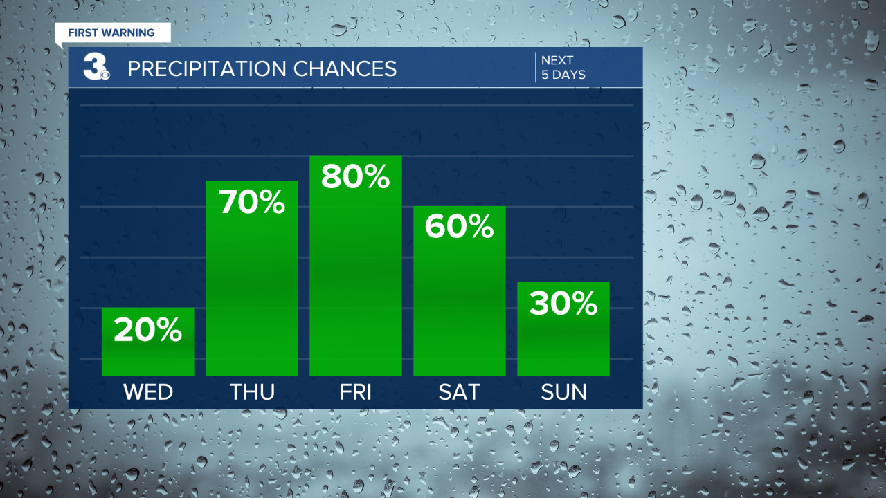
Another day of extreme heat and humidity. Several chances for showers and storms to end the work week.
Hot and humid again today with highs in the mid 90s and an afternoon heat index to 105+. A Heat Advisory is in effect for most of the area from 11 AM to 8 PM. Expect partly cloudy skies today with an isolated shower or storm possible.

A cold front will build in on Thursday and stall out over the Mid-Atlantic, keeping us in a pattern of unsettled weather. Expect partly to mostly cloudy skies tomorrow with scattered showers and storms throughout the day. Highs will drop to the upper 80s but it will still be muggy.
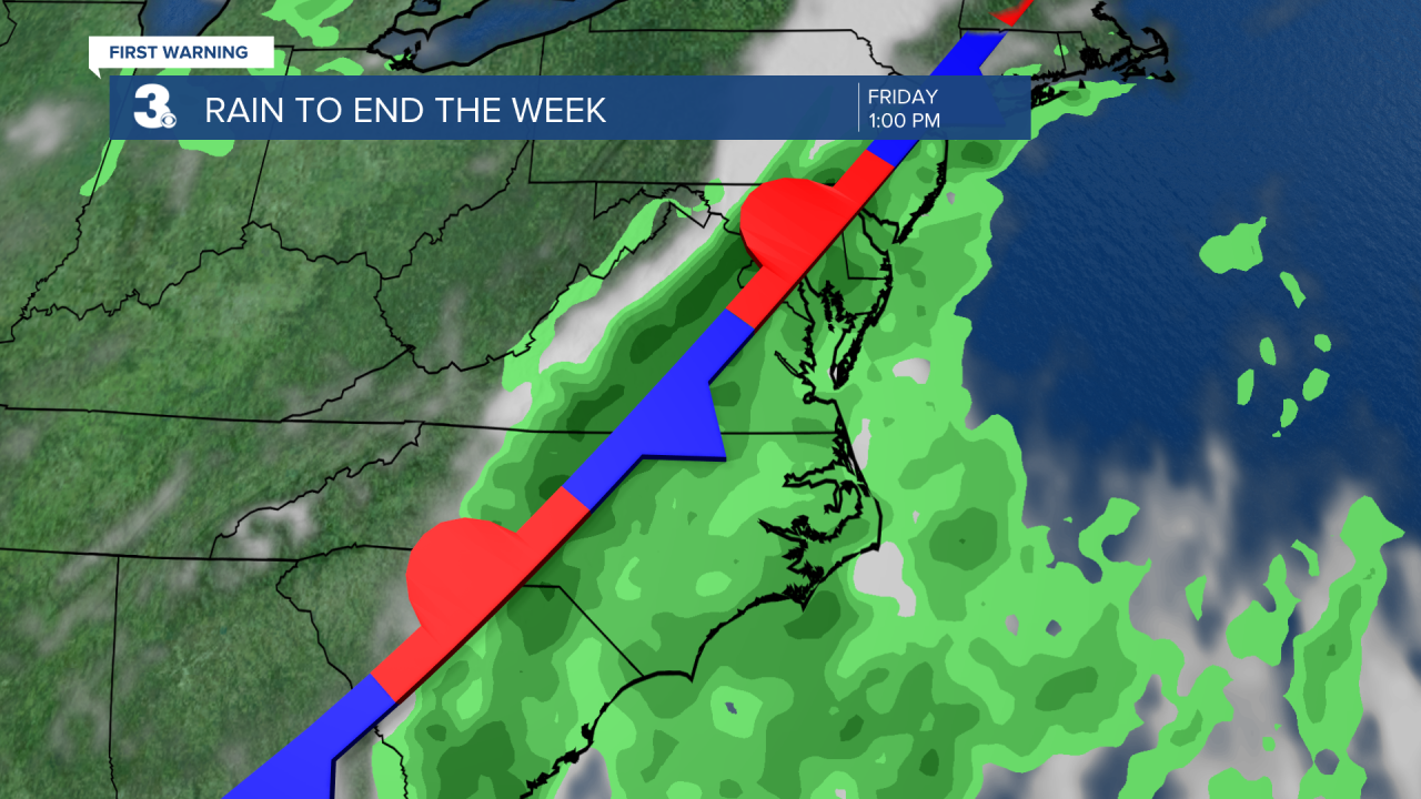
A mix of clouds with showers and storms will continue for Friday and Saturday. Highs will stay in the mid to upper 80s, but it will feel more like the upper 90s with the humidity.
Rain chances will drop for Sunday and early next week, but the temperature will rise. Highs will climb back to the 90s with an afternoon heat index in the triple digits.
Today: Partly Cloudy. Highs in the mid 90s. Winds: S 10-20
Tonight: Partly Cloudy. Lows in the upper 70s. Winds: S 10-15
Tomorrow: Showers & Storms. Highs in the upper 80s. Winds: S 5-10
Tropical Update
No tropical activity at this time
Watch: At least 8 dead from Beryl
Weather & Health
Pollen: Low-Moderate (Grasses)
UV Index: 10 (Extreme)
Air Quality: Good (Code Green)
Mosquitoes: Extreme
Weather updates on social media:
Facebook: MylesHendersonWTKR
Instagram: @MylesHendersonWTKR
X (Twitter): @MHendersonWTKR
