

Meteorologist April Loveland's First Warning Forecast
A cool start to Wednesday. Many areas will wake up in the 50s. A little patchy fog is possible. Temperatures will rebound nicely during the afternoon with highs in the upper 70s and even a few 80s.
A few more clouds will build in on Thursday with highs near 80 once again.

Shower chances will increase on Friday and Saturday as a cold front moves through. A few showers will be possible both days, but there won't be a ton of moisture.

The cold front will also bring in some cooler weather Sunday. Expect highs in the mid 60s. It will feel more like the end of October. Expect plenty of sunshine.
The sunshine will stick around on both Monday and Tuesday. Monday will be cooler with highs in the upper 60s. Tuesday will be warmer with highs in the low 70s.
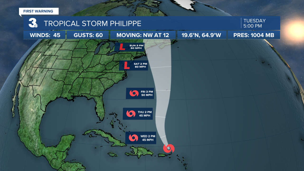
Tropical Update:
Meteorologist April Loveland
For weather updates on Facebook: HERE
Follow me on Twitter: HERE
Follow me on Instagram HERE
Check out the Interactive Radar on WTKR.com: Interactive Radar
