


Meteorologist April Loveland's First Warning Forecast
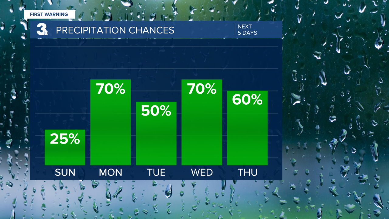
Today starts off pretty tame with partly cloudy skies and highs in the mid 80s. As we head through the day, there's a slight chance of storms. Keep an eye on the sky if you have outdoor plans!
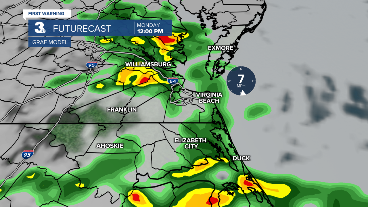
Monday kicks off the workweek with a bang – literally. Expect periods of showers and storms. Temperatures will warm to the low and mid 80s. Don't forget your umbrella!
Tuesday cranks up the heat and the humidity, with temperatures soaring to a steamy 90°F. There's a 50% chance of storms, so while it's hot, those afternoon storms might bring some relief.
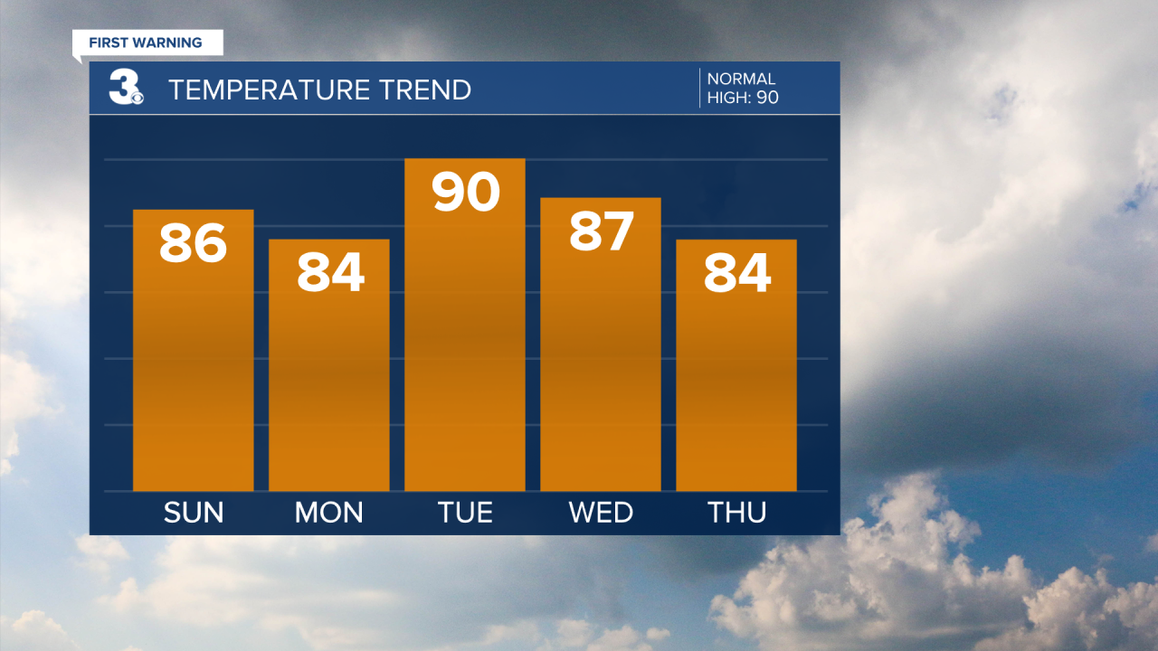
Wednesday brings another round of storms. The high will be around 87°.
The pattern continues on Thursday with scattered storms likely. Temperatures will warm to the low and mid 80s.
Friday doesn't break the trend, with a 50/50 chance of scattered storms and highs in the low 80s.
The stormy weather looks like it's going to carry into the weekend. Highs will top out in the low and mid 80s with scattered showers and storms. Fingers crossed for some dry spells to enjoy outdoor activities!

Meteorologist April Loveland
For weather updates on Facebook: HERE
Follow me on Twitter: HERE
Follow me on Instagram HERE
Check out the Interactive Radar on WTKR.com: Interactive Radar
