


Meteorologist April Loveland's First Warning Forecast
We're continuing with the unsettled weather on Wednesday. It won't be as wet though with a 40% chance of scattered thunderstorms, and the heat index could make it feel close to 100 degrees.
Expect highs around 88 degrees with lows dropping to the mid 70s. Stay hydrated and keep an eye on the sky if you have outdoor plans.
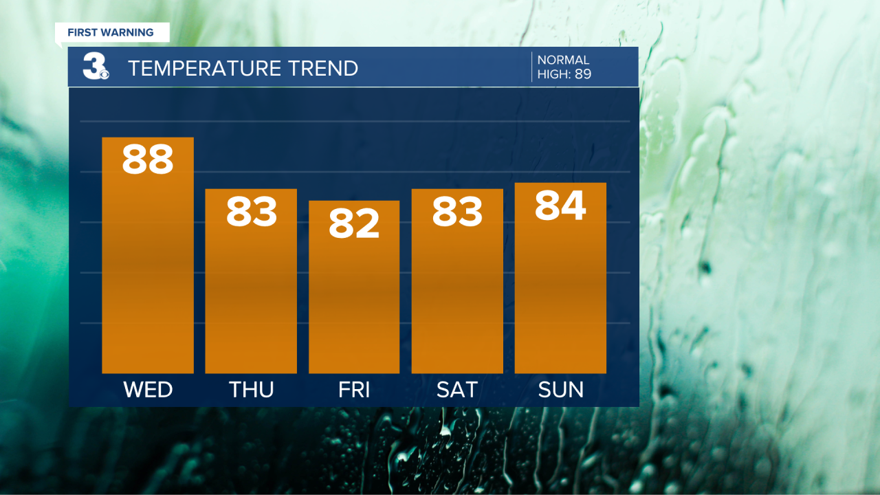
Things are going to ramp up a bit on Thursday. We have an 80% chance of thunderstorms, and with that comes the possibility of flooding in some areas. It's going to be a cooler day, with highs in the low 80s. Make sure to have your rain gear handy and be cautious of any flooded roads.
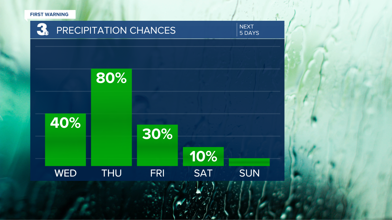
The weather starts to improve on Friday. We've got a slight chance of an early shower, but things should clear up as the day goes on. Highs will be in the low 80s. It's a good day to start planning some weekend activities.
The weekend is looking fantastic! Both days are expected to be dry and milder. Saturday will see highs in the low 80s, while Sunday warms up slightly with no rain expected. Perfect weather for any outdoor events or just relaxing outside.
The new week begins with partly cloudy skies. Highs will be in the low 80s. It's a nice, calm start to the week.
Temperatures start to head higher again with highs in the mid 80s and a 20% chance of a passing shower.

Meteorologist April Loveland
For weather updates on Facebook: HERE
Follow me on Twitter: HERE
Follow me on Instagram HERE
Check out the Interactive Radar on WTKR.com: Interactive Radar
