


Meteorologist Kristy Steward's First Warning Forecast
Happy Friday evening! Temperatures continue to drop this weekend and winds stay breezy, making it feel even colder. Once we survive this cold blast, we’ll get a warm up next week. The tradeoff will be rain though.
Throughout this evening into tonight, we could see a few more sprinkles and flurries fall, but not expecting any accumulation. Tonight, temperatures drop into the low to mid 20s, feeling like the teens with winds gusting to 30 MPH. It will be very cold and windy all weekend long.
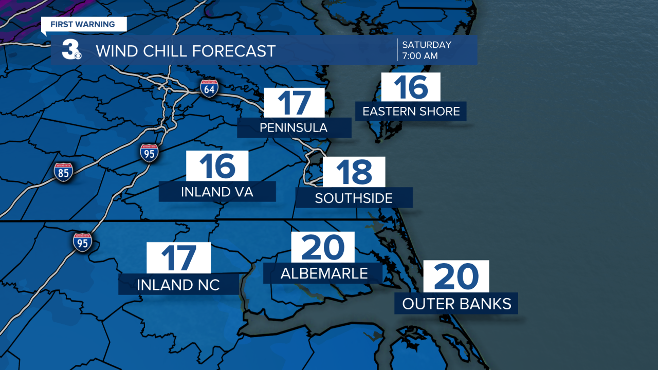
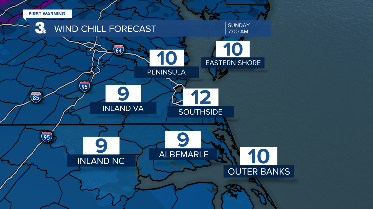
Highs on Saturday in the mid 30s will feel like the lower 20s. Sunday morning, temperatures will be in the upper teens to low 20s, feeling like the single digits.
By Sunday afternoon, we warm into the mid to upper 30s, still feeling like the mid 20s as very breezy winds remain.
Despite the cold this weekend, it will be mostly dry with sunshine. Flurries can’t be ruled out at times Saturday, but if you do see any, they won’t accumulate.

Next week, a warming trend begins. Highs in the mid to upper 40s Monday rise to the mid 50s Tuesday. The workweek starts off dry, then scattered rain arrives with our warmest temperatures Wednesday - Friday. Highs the second half of the workweek in the mid to upper 60s, lows in the mid to upper 50s.

Connect with Meteorologist Kristy Steward:
FACEBOOK
TWITTER
INSTAGRAM
