

Meteorologist April Loveland's First Warning Forecast
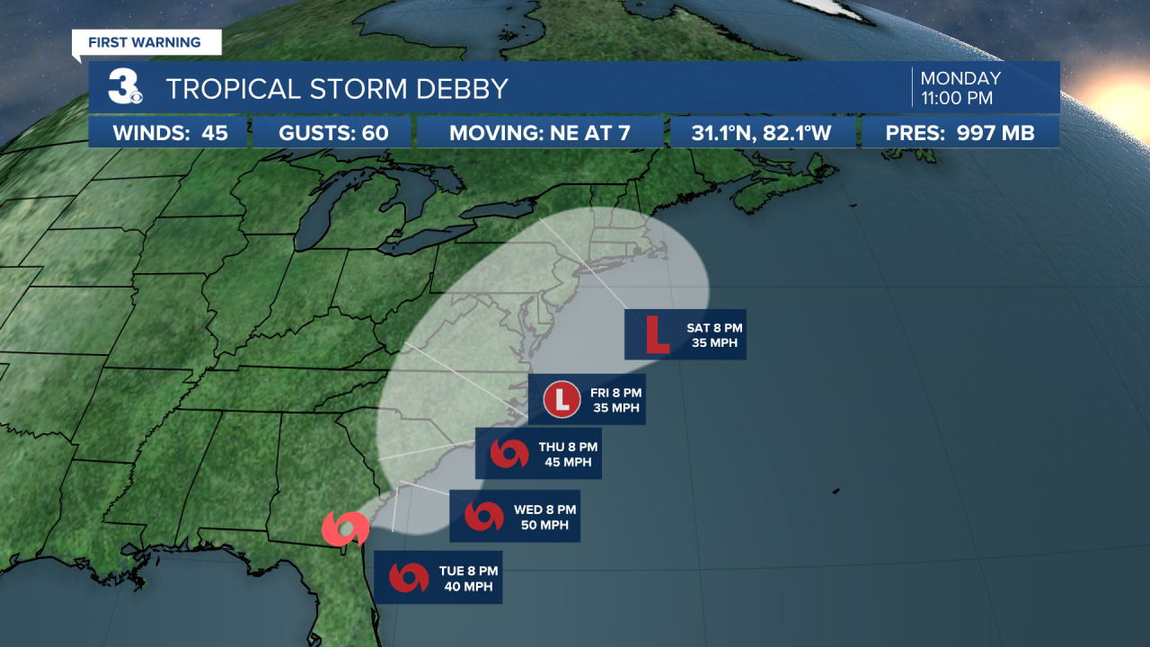
Tropical Storm Debby will be providing a ton of moisture to the area through the weekend.
Showers and storms will be possible especially across North Carolina on Tuesday. Temperatures will top out in the mid 80s, but it will still be quite humid. Expect plenty of cloud cover thanks to Debby.
We will have better chances for showers and storms by Wednesday as Tropical Storm Debby inches closer. Temperatures will trend in the low and mid 80s due to cloud cover.
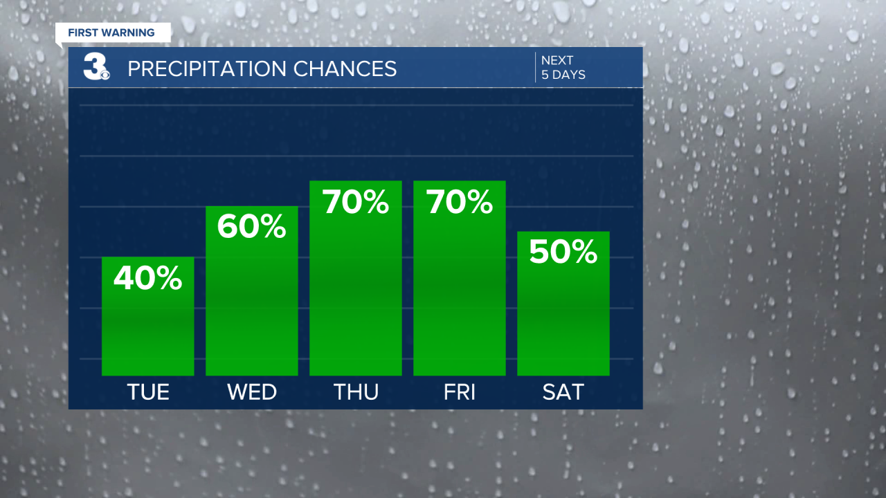
Whatever is left of Debby will continue to impact us Thursday through Saturday. That means we have the chance to see quite a bit of rainfall. This could lead to flooding. Heavy rain is the main threat as of now from Debby, but we will also need to keep an eye on the potential for tornadoes.
Showers and storms will continue on Friday and Saturday. As of now it looks like we could potentially pick up 4-8 inches of rain over the next 7 days. Of course, a lot is dependent on the track of Debby.
Now is a good time to prepare and make sure you have you emergency supply kit ready!
Stay tuned for any updates!
Meteorologist April Loveland
For weather updates on Facebook: HERE
Follow me on Twitter: HERE
Follow me on Instagram HERE
Check out the Interactive Radar on WTKR.com: Interactive Radar
