


Meteorologist Kristy Steward's First Warning Forecast
Good Sunday morning! The powerful Canadian cold front we’ve been talking about this past week finally passed through last night! Cooler, drier air will continue to filter in Sunday and will stick around for a little while.
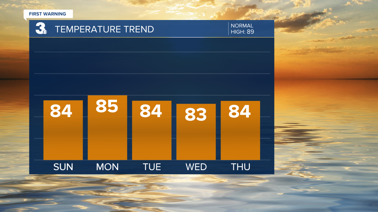
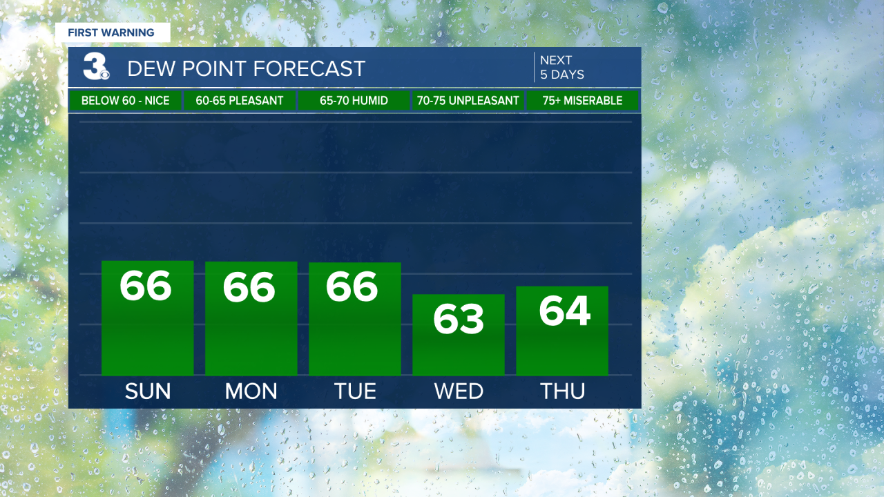
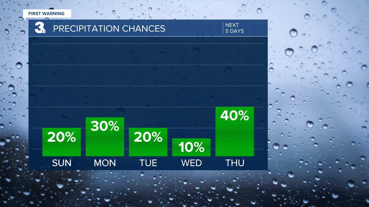
There are a few lingering showers across the Outer Banks this morning, but that will clear by the afternoon. Throughout the day Sunday, dew points will gradually drop. Temperatures will only warm up a few degrees into the mid 80s for highs. Enjoy the cooler temperatures and plenty of sunshine today!

Much of the workweek keeps the same low humidity and below-average temperatures around. Highs through Thursday will be in the mid 80s with very low humidity.
Isolated to widely scattered showers and storms are possible Monday afternoon, but several locations look to remain dry. We’ll all be dry Tuesday and Wednesday. Scattered thunderstorms return to the forecast Thursday and storm chances continue into next weekend.
Heading into next weekend will also be a little warmer with humidity on the rise Friday and temperatures climbing to the upper 80s.
Connect with Meteorologist Kristy Steward:
FACEBOOK
TWITTER
INSTAGRAM
