

Forecaster Derrah Getter’s First Warning Forecast
Multiple rounds of strong to severe storms move through tonight as a cold front clears the region. A severe thunderstorm watch will be in effect until 11 pm. Lingering showers and storms will be possible early Monday morning, so watch out for slick roads and localized flooding on the morning commute.
High temperatures will only warm to the low 80s. Below normal temperatures will continue for Tuesday. By the middle of the week the heat and humidity will begin building back in.

The 4th of July is looking good for the most part, mainly sunny and hot with isolated storm chances. As we head into the upcoming weekend things get steamy again with highs reaching the mid 90s. The daily chance for a shower or storm returns late week.

Tropical Update
As of 5 pm 6/30/24

Hurricane Beryl is currently a category 4 hurricane. It is the first major hurricane of the 2024 Atlantic hurricane season. It is also only one of three major hurricanes that have occurred in June since records began in 1842. It is expected to weaken to a category 3 hurricane by early next week as it moves through the Caribbean Sea.
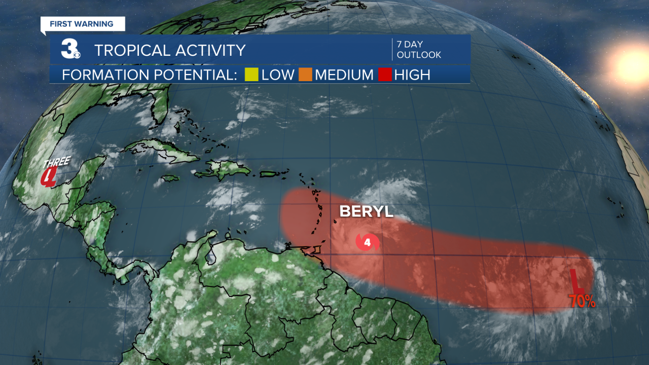
A tropical depression has formed over the Bay of Campeche. It will fizzle out over land as it continues to move westward.
Showers and thunderstorms southwest of the Cabo Verde Islands are associated with an area of low pressure. A tropical depression is likely to form by the middle of this week.
- 40% formation chance through 48 hours (MEDIUM)
- 70% formation chance through 7 days (HIGH)
Let's connect on social media!
Forecaster Derrah Getter:
For weather updates on Facebook: HERE
For weather updates on Twitter: HERE
Follow me on Instagram: HERE
Check out the Interactive Radar on WTKR.com: Interactive Radar
