


Meteorologist Kristy Steward's First Warning Forecast
Happy Tuesday evening! The cold front that passed through today will leave us with a beautiful Wednesday. Then, temperatures rise before another front brings falling temperatures and increasing storm chances.
Tonight, clouds will clear out and humidity will continue to gradually drop. We’ll wake up to temperatures in the upper 60s Wednesday. Make some plans to get outside in the afternoon! High temperatures will be in the low 80s with very low humidity and tons of sunshine. Quite the treat! Unfortunately, it won’t last long.
Temperatures rise into the mid to upper 80s Thursday as a warm front moves through. Around the warm front, there could be a round of showers Thursday afternoon and evening.

Spotty showers are possible Friday, but the bigger story will be the high heat. High temperatures in the mid 90s, feeling like 100-105°. A cold front comes to the rescue Saturday. Still hot ahead of the front with temperatures reaching the upper 80s, feeling like the mid 90s. Around the cold front, expect scattered showers and storms Saturday afternoon and evening.

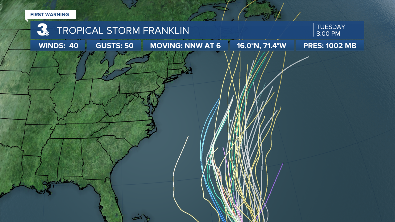
Beyond this is when the forecast gets a bit more uncertain. If the front is able to pass through, we’ll be drier Sunday into the start of next week. However, Tropical Storm Franklin is expected to be near Bermuda later this weekend into next week. Depending how strong Franklin is, it could cause our cold front to stall over the top of Hampton Roads. In that case, we’ll have off and on rounds of scattered showers and storms lasting the first half of next week.
Outside of the rain chance, expect a rough surf in the Atlantic from Franklin this weekend into next week.

Regardless of whether the cold front stalls or not, temperatures will be able to cool down into the lower 80s for Sunday into the first part of next week.
Connect with Meteorologist Kristy Steward:
FACEBOOK
TWITTER
INSTAGRAM
