Meteorologist Myles Henderson’s First Warning Forecast
Extreme heat and humidity to end the week. Several days with a chance for storms, including this weekend.
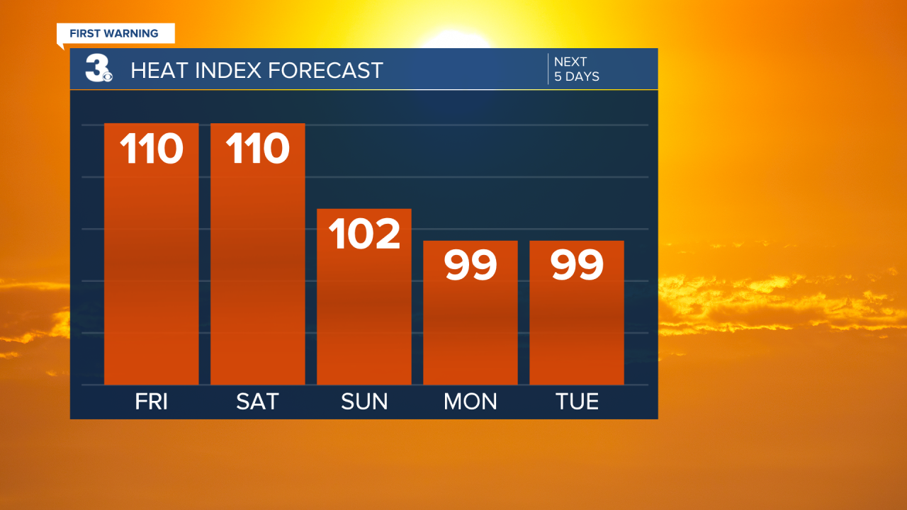
More heat and humidity today with highs in the mid to upper 90s and an afternoon heat index near 110. Expect partly cloudy skies with a “pop-up” shower or storm possible in the afternoon to evening.

Partly cloudy with scattered showers and storms this weekend, mainly during the afternoon/evening hours. Highs will return to the mid 90s on Saturday with an afternoon heat index near 110. Highs will dip to near 90 on Sunday, with an afternoon heat index to 100+.

This summer-like pattern of heat, humidity, and scattered storms will continue for much of next week. Highs will linger in the upper 80s to low 90s, but it will feel more like the upper 90s to near 100 with the added humidity.
Today: Partly Cloudy. Highs in the mid 90s. Winds: SW 5-15
Tonight: Partly Cloudy. Lows in the mid 70s. Winds: SW 5-10
Tomorrow: Partly Cloudy. Highs in the mid 90s. Winds: S 5-15
Tropical Update
Hurricane Beryl moving over the Yucatan Peninsula today. Beryl is expected to emerge over the southwestern Gulf of Mexico tonight and move northwest toward northeastern Mexico and southern Texas by the end of the weekend.
Maximum sustained winds remain near 110 mph with higher gusts. Rapid weakening is expected while Beryl crosses the Yucatan Peninsula, but slow re-intensification is expected when Beryl moves over the Gulf of Mexico.

Weather & Health
Pollen: Low-Moderate (Grasses)
UV Index: 10 (Extreme)
Air Quality: Moderate (Code Yellow)
Mosquitoes: Extreme
Weather updates on social media:
Facebook: MylesHendersonWTKR
Instagram: @MylesHendersonWTKR
X (Twitter): @MHendersonWTKR


